Petroglyphs and Cowboys

August 25th, 2014

Monday – August 25,2014     52 degrees & cloudy

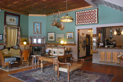
The Plaza Hotel in Thermopolis, Wyoming was lovely and comfortable but since it was located directly on the hot spring, it smelled of sulphur. We didn’t try the naturally warm pool but enjoyed a decent breakfast and left to see ancient petroglyphs.

DSC_3436Far From the Middle of Nowhere

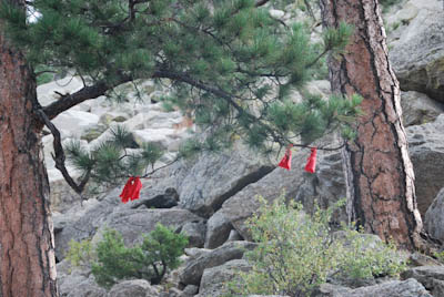
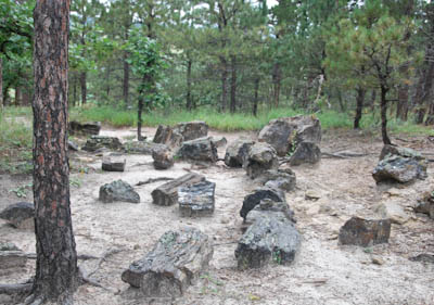
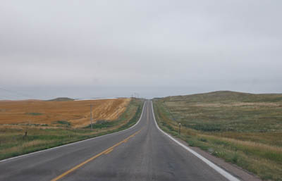
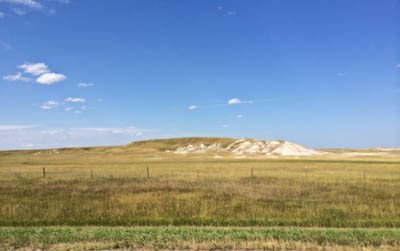
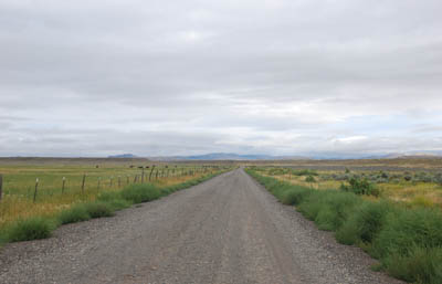
Legend Rock Petroglyphs was located about twenty miles east of Thermopolis, out in the middle of barren nowhere. Visitors have to obtain a key to the grounds before they drive out or make sure that someone is out there.
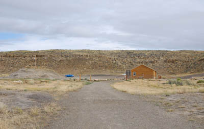
DSC_3441Caretaker’s Cabin

A tall stout woman wearing western jeans and a cowboy hat greeted us as we drove in. She sat in a comfortable lawn chair and looked like she was expecting us.  The woman explained the history of the area and the drawings. We learned that Shamans made pilgrimages to this sacred land to gain wisdom and power. Some left marks on the rocks to express a variety of ideas, symbols, and experiences.
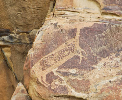
DSC_3446Petroglyph

Thunderbirds and horned animals represented power which was transferred to the Shamans. Some of the petroglyphs were believed to be dated from 8000 BC – 6000 BC.

DSC_3452
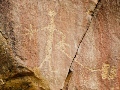
Dinwoody Tradition Style Petroglyph

The figure with a line connecting it to two objects is believed to be a person connected to the spirit world of the rock.
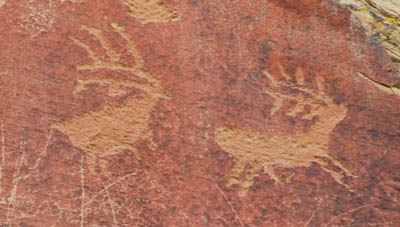
DSC_3471Elk Petroglyphs

The two elk pictured above are believed to be just two thousand years old. The oldest petroglyphs in Legend Rock were approximately 11,ooo years old, according to the caretaker. They are drawings of bison, elk, bighorn sheep, and deer.
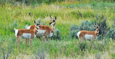
DSC_3482Pronghorn Deer

Driving away from Legend Rock Petroglyphs we saw pronghorn deer which have very unusual markings.
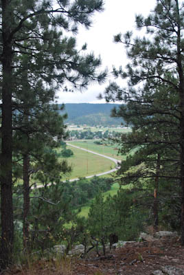
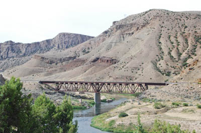
DSC_3509Wind River Canyon

We drove twenty miles back to Thermopolis and returned to Route 20 West. The terrain immediately changed as we left town. We passed through a steep canyon and then through many miles of the Wind River Indian Reservation. The flat barren land was broken up by tiny towns with small cement-block casinos.
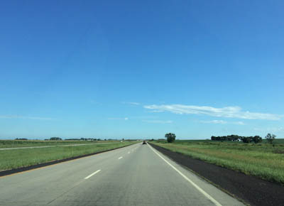
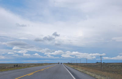
DSC_3518Route 20 West

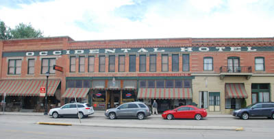
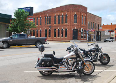
After several hours of driving through flat corn & soy fields and cattle ranches, we stopped in Lander, Wy.  at the Gannett Grill for a tasty lunch.
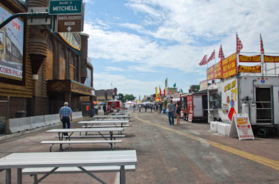
DSC_3528Lander, Wyoming

DSC_3530
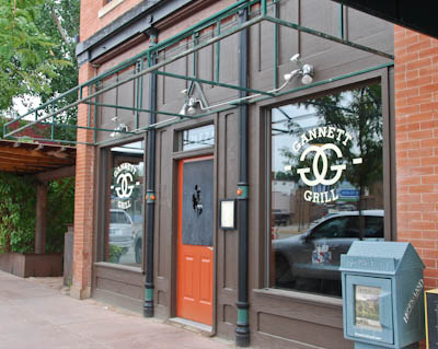
Gannett Grill in Lander, Wyoming
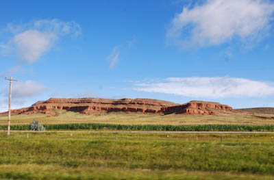
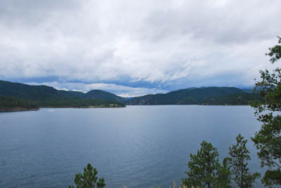
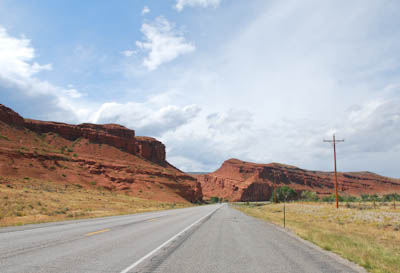
DSC_3540Red Rock Canyon

We knew we were getting close to Yellowstone because the land slowly became more interesting.  We stopped for gas in a town called Shoshoni – population: 629 elevation: 4839 feet. We had 2695 miles on the car odometer since we left New York.

DSC_3543Approaching the Tetons

It was a glorious sight to watch the towering peaks of the Grand Teton Mountains rise on the horizon as we approached Jackson Hole. It was 5:30 PM, we had driven all day and were happy to finally reach our destination.
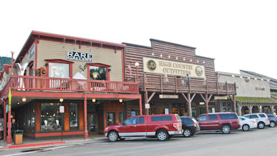
DSC_3562Jackson Hole, Wy.

DSC_3574Jackson Hole Stagecoach
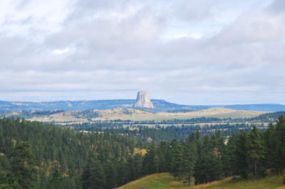
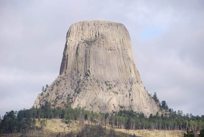
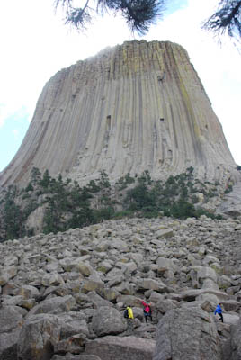
DSC_3566Wildlife Photo?

Towers & Hot Springs

August 24th, 2014

Sunday – August 24, 2014     63 degrees and sunny

DSC_3312Wyoming Welcome

We checked out of the hotel in South Dakota early in the morning and drove northwest along Interstate 90. Traffic was light and the broad western sky was a brilliant shade of blue.

DSC_3308Beautiful Day

We had noticed Devil’s Tower on the map and thought it might be fun to see the monument. We reminisced about the 1977 science fiction movie which had introduced us to the tower. Jeff hated the movie! I thought it was interesting at the time.

DSC_3326Approaching the Tower

There are several theories about the formation of the monument and it was a sacred place for the Native Americans who had lived in the region.

DSC_3339Shadows Across the Tower

DSC_3352Climbers

DSC_3358Prayer Cloths

DSC_3367Devils Tower

DSC_3379Heading West

DSC_3390Buffalo, Wyoming

We stopped for lunch in a town called Buffalo. There was an old historic hotel on Main Street and as we were peering into the windows, a young woman standing outside encouraged us to go in to take pictures. The receptionist behind the old desk welcomed us and talked about the history of the building.

DSC_33871880s Occidental Hotel

DSC_3414Lobby of the Occidental

We had a very delicious Mexican lunch at the Cantina across the street from the hotel.

DSC_3396Mexican Cantina

Back in the car, we continued our drive to Thermopolis, Wyoming. The Plaza Hotel turned out to be an historic building on the National Register of Historic Places. It was created as a hotel and apartments in 1918 and is located in Hot Springs State Park. It was built to accommodate guests who wanted to bathe in the curative warm mineral waters.

DSC_3418Best Western Plaza Hotel – Thermopolis

There were several mounds of steaming multi-colored ‘rocks’ in town called Hot Springs Teepees. These were formed by putting a pipe in the earth which allowed the hot mineral water to pour out. Over the years the minerals calcified and grew to form the existing weird formations.

DSC_3432Hot Springs Teepee

Presidents in the Rain

August 23rd, 2014

Saturday – August 23, 2014     64 degrees & mostly cloudy

It rained last night and large menacing clouds hung low in the sky when we awoke. Today we planned to have a ‘down day’ so we had a leisurely breakfast in the hotel in Rapid City. Jeff had read about a local attraction called The Petrified Forest of the Black Hills  which, according to Trip Advisor, was worth seeing.

DSC_3209Trail in the Petrified Forest

We plotted a course on the cell phone and twenty minutes later we were driving up a steep hill off a back road behind campers and cabins. There was a small admission charge which included a twenty minute video, the small museum, and a self-directed trail guide.

DSC_3213Section of a Petrified Log

Numbers on the guide identified significant pieces of petrified logs along the trail. The forest had existed in this location millions of years ago and the petrified wood was discovered during the 1920s. From a distance, they resembled huge rocks because most of the trees had been over one hundred feet tall.

DSC_3219Scattered Logs

DSC_3227More Petrified Logs

My photographs really do not do justice to the park and we actually enjoyed the visit. The video was excellent and explained rock formations in this part of the world. Hiking on the trail through the cedar and pine forest also was great fun. 

DSC_3228View Across the Valley

Our next stop was Sturgis, South Dakota, Harley Davidson motorcycle Mecca. Although Jeff kept saying I was the one who wanted to go to this famous town, I think he was curious too. Fortunately, we missed the annual rally which happened earlier in the month. 

DSC_3242Sign Across Main Street in Sturgis

DSC_3244Tacky Main Street

DSC_3246Store Sign

What did we do in bike heaven? We walked around, did a little window shopping, admired the motorcycles that rumbled down Main Street, and bought a couple of T-shirts.

DSC_3247T-Shirt Store

DSC_3257Inside a T-Shirt Store

DSC_3251Photo of the Crowd During Rally Week

DSC_3259The Bank Saloon

We pulled ourselves away from Sturgis and drove to Deadwood, South Dakota which was a short ride away. Named after dead trees found nearby, the city has a National Historic District which had sounded interesting. Deadwood gained notoriety as a wild and lawless place and attracted gamblers and prostitutes during the ‘Wild West’ of the late 1800s. The graves of Wild Bill Hickok and Calamity Jane are in the local Mount Moriah Cemetery.

DSC_3261Sign in Deadwood, SD

Caught in a long line of traffic as we approached Deadwood, we waited patiently. As we approached the town, we saw that Main Street was closed for an antique car rally and street fair. Loud rock ‘n’ roll music poured out from an entertainment tent and parking was impossible. We decided not to stop and continue on a quiet scenic road toward Mt. Rushmore.


DSC_3267Pactola Dam & Reservoir

DSC_3270Driving Into Keystone, SD

Keystone was the town located at the entrance to Mt. Rushmore National Monument. It had started to rain as we drove through. The town was full of tacky souvenir shops, fast food restaurants, cheap motels, fudge & ice-cream stands, and tourist families.

DSC_3272Main Street, Keystone

We continued up the hill and parked in a new parking lot. I had read about recent improvements to the facility including a modern visitor’s center. We donned our rain gear and walked toward the statues.

DSC_3274Mt. Rushmore

DSC_3280Presidents in the Rain

The presidents looked a little sad in the rain. Washington seemed to have tears running down his face and his nose was running. We stopped in the gift shop to see tacky presidential novelties. We were especially drawn to the plastic bobble-head Jeffersons. No wonder they were sad.

DSC_3294Borglum’s Dream

By the time we left the shop, the sun was shining again so we took a few more photos. The light was better and the quartet looked much happier. Four hundred workers carved the faces onto the granite side of the mountain from 1927 -1939.

DSC_3298Rain Clouds

By the time we returned to Rapid City SD, the sun came out and the storm clouds were moving away. One of the most amazing aspects of this trip has been the clouds. The land is so flat and the horizon is so vast that the sky is a huge 360 degree dome which surrounds a person offering great vistas of ever-changing clouds.

DSC_3300View of the Prairie From the Hotel Window

Badlands National Park

August 22nd, 2014

Friday – August 22, 2014      63 degrees & cloudy

The real reason we stayed overnight in Wall, SD was not because we had to see Wall Drug but to visit Badlands National Park.

DSC_3122Road to The Badlands

It was a short and easy drive to the National Park loop road which was like the mid-western prairie we’ve been looking at for the last two days. Then a sign led us to a scenic overlook and the earth literally opened and we were standing on top of the world, overlooking a deep chasm.

DSC_3131Big Horn Sheep

DSC_3130Photographer on the Edge

Big horn sheep clung to the cliffs and tourists walked out as far as they could to peer at the eroded landscape.

DSC_3136Warning!

DSC_3133Colorful

We drove along the road and stopped at several overlooks to take photographs. Unfortunately, it was an overcast day and the colored stripes of land erosion were muted.

DSC_3175Tourists on the Overlook

Badlands National Park reminded us of the natural formations in Utah. We talked about the surprise the early pioneers must have experienced when they came upon these unfriendly cliffs in their westward journey. I understood why Lewis and Clark and their entourage traveled north.

DSC_3179Amazing Views

DSC_3180Road Through the Park

DSC_3185

DSC_3196Sign in the town of Interior, South Dakota


Into Another Time Zone

August 22nd, 2014

Thursday – August 21, 2014    Sunny & 75 degrees

DSC_2773My Homage to Corn

The day started in Sioux City North, South Dakota which is a stone’s throw from Sioux City, Iowa. I was tired and cranky last night but slept well and felt better this morning after a good night’s sleep. We were on Route 29 heading north by 9:30 AM and looking forward to another day on the road.

IMG_8274Yes, That’s Corn on Both Sides of the Road

The speed limit on the highway was 75 MPH so it’s intense driving especially among very large trucks. But the roads were straight with a grassy area separating the vehicles going in opposite directions. Jeff said he was sorry he didn’t bring a couple of bungee cords to tie the steering wheel in place. “Then with cruise control, the car could drive itself,” he stated.

DSC_3054Street in Front of the Corn Palace

After about an hour, we got onto Interstate 90 West. This was another flat, straight ribbon of highway running between green cornfields reaching out to the horizon. We knew we were getting close to the wild west when we passed a billboard which read: Eat Steak – Wear Fur – Keep Your Guns!  

DSC_3062The Mitchell Corn Palace

We decided to take a break and stopped in Mitchell, SD which is home to the famous “Corn Palace.” Neither of us knew what it was which is why we wanted to see it. We followed good signs into town and parked the car. The street in front of the palace was closed to vehicles because of a street fair. There was food at one end, crafts in the middle, and amusement rides at the far end of the street. 

DSC_3058Food Truck

DSC_3064Corn Decoration on the Side of the Palace

We walked down the street admiring the decorations made of corn and hay on the exterior of the building. The entrance was around the corner and since the sign on the door said “free,” we went into the palace. We discovered that The Corn Palace was a sports arena and entertainment venue. A crew was setting up the stage for a Chris Young country music performance for tonight. Basketball hoops were pushed to the ceiling, chairs were set up, and corn decorations lined the walls.

DSC_3075Inside The Corn Palace

On the way back to the car, we stopped for a quick lunch at a bar-b-que truck and took more photos. This is NOT what we ate for lunch:

DSC_3057The High Cholesterol Diet

DSC_3059Now I know where all the Twinkies went!

We bought gas for $3.19 a gallon and found I-90 West. This was another day spent in the car admiring the South Dakota scenery. Similar to Iowa, there are vast flat farmlands with miles of cornfields in all directions. The most surprising and amazing discovery was that there were four or five bars and 4G AT&T service on my cell phone in both states. That’s better service than I receive at home!

DSC_3083Interstate 90 Crossing the Missouri River

IMG_8291Diversity in the Landscape

DSC_3089More Hills

Finally, Exit 110 appeared and we got off to spend the night in Wall, SD which is home to the famous Wall Drug Store. It was five o’clock when we checked into one of the motels in town. We had been on the road, with a stop in Mitchell, and stops to change drivers for almost eight hours on 75 MPH Interstates. We were tired!

DSC_3097Wall Drug Store in Wall, South Dakota

DSC_3114Wall Drug Backyard

Wall Drug is a collection of tacky little shops along a Western theme street in the tiny town of Wall, SD (population 843) in the middle of nowhere just off Interstate 90. I remember seeing their bumper stickers on cars in New York in the 1960s & ’70s. Like South of the Border on Rt 95 and The Roscoe Dinner on Rt 17, Wall Drug is a travelers’ institution.

DSC_3099Shops Inside Wall Drug

IMG_8294Moose Drool