Jericho, Nabi Musa, Wadi Qelt, & Bethany

October 20th, 2017

Friday – October 20, 2017

All good things must come to an end.  This was the last day of the Overseas Adventure Travel tour: Israel: the Holy Land & Timeless Cultures.  I had been traveling in Jordan, Israel, and Palestine since September 24th and I was getting a bit ‘road weary.’  The schedule for the day was packed with interesting sights in the West Bank.

After a pleasant evening in the hotel in Jericho, our first destination was the Mount of Temptation.  This was a hill in the Judean desert where it was believed that the temptation of Christ took place.  On top of the cliff there is a modern wall that sits on the ruins of a fortress which dates from about 130BC.

Half way up the mountain is the Greek Orthodox Monastery of the Temptation or Deir al-Qarantal in Arabic.  Access to the monastery is by cable cars, which leaves tourists in a cliffside complex of restaurants, shops, and a cafe.

It was a climb down on a wide path along the side of the mountain and then up steep limestone stairs to reach the monastery.

There was a wonderful view of the city of Jericho and the distant mountains from the monastery:

The earliest monastery was constructed by the Byzantines in the 6th century above the cave traditionally said to the place where Jesus spent 40 days and nights fasting and meditating.  Jericho was conquered by the Arabs in the 630s and centuries later invaded by the Crusaders in 1099.  Two churches were built on the mountain at that time.

The current monastery was built in 1895 around a cave chapel that marks the stone where Jesus supposedly sat and prayed.

It was great fun to ride in the cable cars and see the panoramic view of the city of Jericho and the ruins of the archeological site we had visited yesterday.

We then drove out into the desert to Nabi Musa.  On the way we saw a large group of jeeps gathering on top of a sandy hill for a road race or Jeep surfing.

Nabi Musa means “Prophet Moses” in Arabic and it is believed that this is the site of the tomb of Moses.

This is also the name of a seven-day festival held here in the spring.  The celebration is considered “the most important Muslim pilgrimage in Palestine.”  The Jerusalem-Jericho road was one of the primary routes used to make a pilgrimage to Mecca.

Originally, the building was a point from which pilgrims could look across the Jordan Valley to see Mout Nebo where the tomb of Moses was thought to be located.

Negev Bedouin tribes share a belief in the sanctity of the site.  We looked into one of the stone rooms at the large sarcophagus covered with a green silk cloth.  There was much reconstruction going on which was planned to be finished in 2018.

We left and drove through the desert again to the city of Al-Eizariya, sometimes referred to by its medieval name of Bethany.

The city is located on the southeastern slope of the Mount of Olives (Area B), less that two miles from Jerusalem.  The name al-Eizariya refers to the story of Lazarus of Bethany who was raised from the dead.

We were lucky to be able to gain access into the Roman Catholic Church of Saint Lazarus, which was completed in 1955 and is under the “Custody of the Holy Land Franciscan Friars.”

Since the 16th century, the site of the tomb has been occupied by the al-Uzair Mosque.  The entrance to the tomb today is down a flight of uneven rock-cut steps from the street to a square chamber serving as a place of prayer.  There were additional steps leading to a lower chamber believed to be the tomb of Lazarus.

We had an excellent Palestinian lunch nearby in Bethany, then continued further into the desert to Wadi Qelt in the eastern part of the West Bank, occupied territories.  The valley, or wadi in Arabic, is believed to be the “Valley of the Shadow” mentioned in Psalm 23.

The bus stopped and parked by the side of the road and we got off to look around at the magnificent scenery.  We just needed a caravan of camels to complete the picture.

We walked up to the top of the hill with a band of Israeli bicyclists.  I watched as the young men peddled their bicycles over the rough terrain.

At the summit, we were all rewarded with a view across the valley of the Monastery of St. George of Choziba.  The monastery is a religious complex carved into the sheer rock wall of a narrow gorge.  The valley parallels the old Roman road to Jericho and is the backdrop for the parable of the Good Samaritan.

St. George’s Monastery began in the 4th century with a few monks who wanted a desert experience and lived in caves along the cliffs.  The monastery was founded in the 5th century by John of Thebes, but named after another monk, St. George of Koziba.

The monastery went through many centuries of destruction and rebuilding.  It was completely restored by a Greek monk named Callinicos between 1878 to 1901.  A few monks still live in the compound which is one of five monasteries still functioning in the Judean Desert.  The monastery is open to pilgrims and visitors.  Recently, access has been improved for visitors who wish to hike for three hours to get to the complex.

We drove back to the city of Jericho, which means “city of palms,” and walked around the center of town.

Our last stop for the day was “The Old Sycamore Tree,” which recalls a biblical story of the tax collector, Zacchaeus.  The tree has helped Jericho to attract visitors and pilgrims to the city.

The tree is on the pastoral grounds of the new Russian Museum, which was built in 2011.  However, we did not have time to visit.

Like every other place I have visited, among the archeological and historical sights, the real treasures are the people who live there and interact with us.  The Palestinian man in the photo below offered us dates and sang a lovely song to our group in English.  He spoke about kindness and good will toward all people.

Back at the hotel we enjoyed a wonderful farewell dinner and said our goodbyes to each other and to Hisham Ikhmayes, our excellent Palestinian guide.  Hours later, a car drove me from Jericho to the airport in Tel Aviv.  Driving quickly along dark roads through Israel at four o’clock in the morning was a fitting end to this amazing journey in this part of the Middle East.

I took the picture above from my window on the plane in Paris.  It had been raining and the sun was attempting to rise.  No more deserts.  No more camels.  No more palm trees.  I was north again; almost home…..

Nablus, Mount Gerizim, and Sebastia

October 19th, 2017

Thursday – October 19, 2017

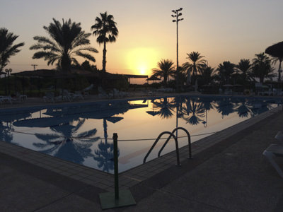
We had to have an early start because we had a full schedule planned for today.  That’s my photo of the sun rising over the pool at the Jericho Resort Village.  After breakfast we drove north to the city of Nablus, whose biblical name was Shechem.  

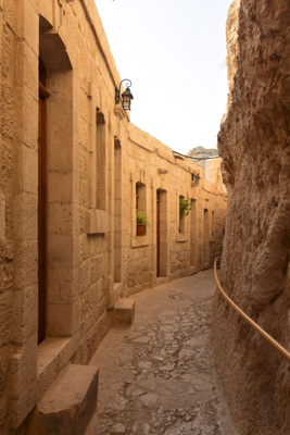
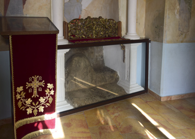
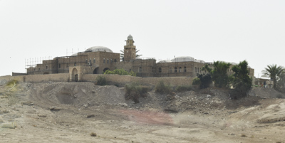
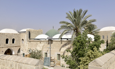
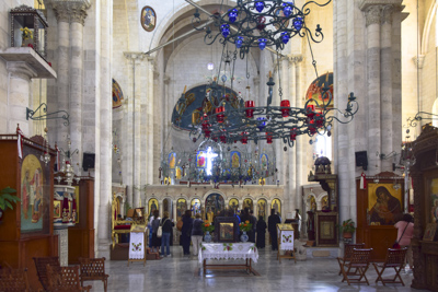
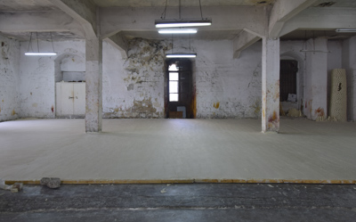
Our first stop in Nablus was to see Jacob’s Well which is located within the Greek Orthodox Church of St. Photini at Bir Ya’qub.   By 330 AD, this site had been identified as the place where Jesus held a conversation with a Samaritan woman.  The first church was built over the site in 384 AD.  Several other churches were built and destroyed over the centuries.

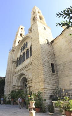
In 1860, the site was obtained by the Greek Orthodox church and a new church, dedicated to St. Photini the Samaritan, was built along with a monastery.  An earthquake destroyed the building in 1927.

Father Ioustinos led a major reconstruction project to rebuild the church and restore Jacob’s Well in a crypt on a lower level.

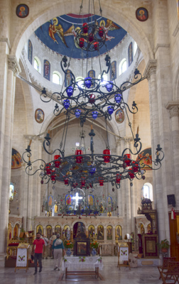
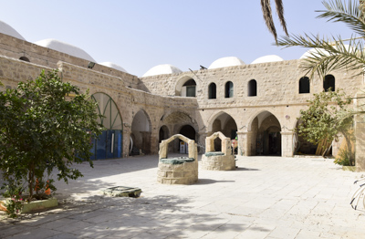
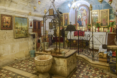
Jacob’s Well is accessed by entering the church and descending stairs to the crypt where the well is located.  There is a winch with a handle and a bucket to draw water.

A group of Greek monks and other tourists arrived and the priests conducted a service in the sanctuary.

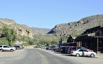
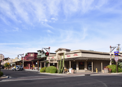
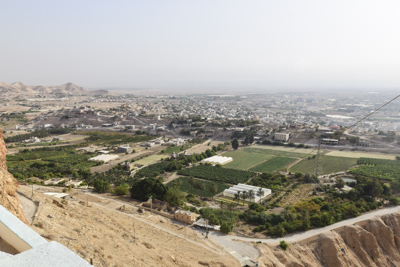
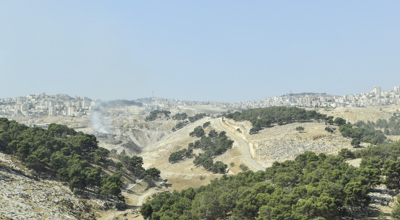
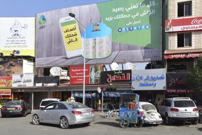
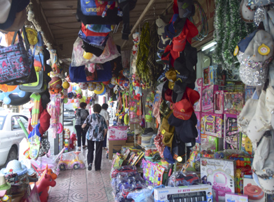
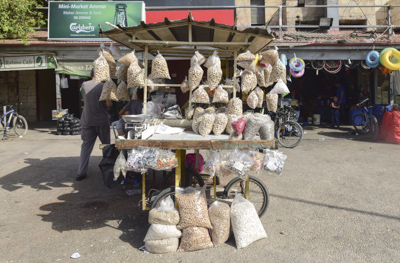
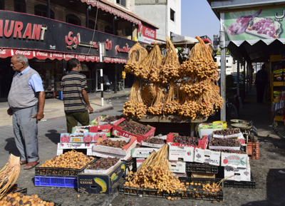
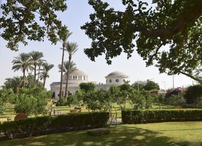
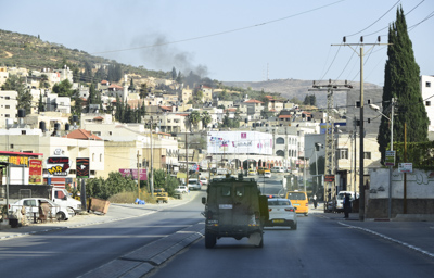
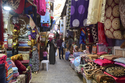
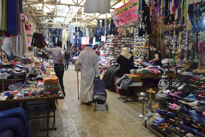
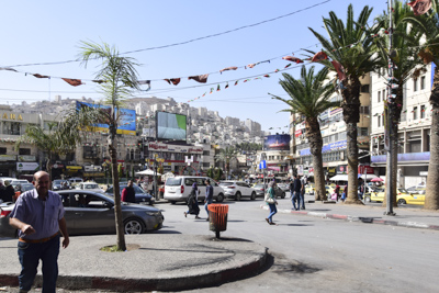
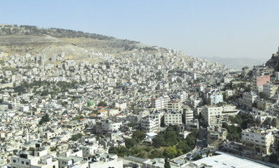
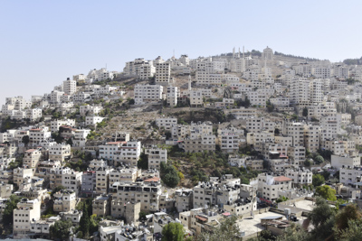
We left the church and drove to the center of Nablus, an ancient city located in a narrow valley between two mountains.  There are about 150,000 inhabitants in Nablus.  The city is a Palestinian commercial and cultural center, containing a large university and the Palestinian stock-exchange.  We walked into a huge souq or market.

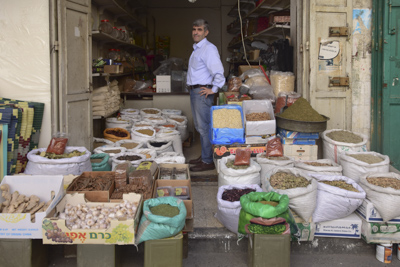
We left the market and crossed the busy intersection to a commercial street.  Hisham pointed out the Touqan Soap Factory which made soap using virgin olive oil, water and an alkaline sodium compound.  The finished soap is ivory-colored and has almost no scent.

The ingredients of “Nabulsi” soap are heated in large copper vats and stirred continuously for eight days.  The liquid soap was spread evenly on the floor of the factory.  After it is set, the soap was cut into cubes and dried, for months, by stacking them in a high “cone” to allow air to circulate around the cubes.

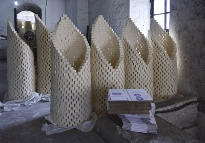
The floor of the factory was waxy and slippery and a little scary to walk on.  We left and walked to the next corner of the busy city.

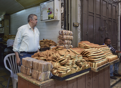
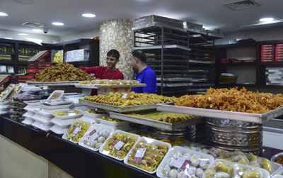
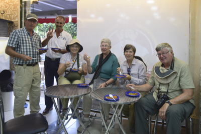
Hisham directed us to a neighborhood bakery called Abu Salha Sweets and ordered knafe – an Arab pastry made with cheese.  My guide book said the knafe in Nablus is “the best you will ever eat.”

Fortified with knafe, we boarded the bus and drove up a steep road up to the top of Mount Gerizim which is home to the last remaining community of Samaritans.  There are only 400 Samaritans left and they continue to practice some of the region’s strictest and most ancient religious traditions.

Samaritans believe that Moses ordered them to live on Mount Gerizim to protect it as a sacred holy temple mount 3,600 years ago.  The mountain is one of the highest peaks in the West Bank and continues to be the center of the Samaritan religion.  It is a UNESCO World Heritage Site.

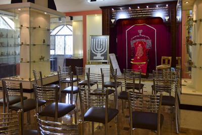
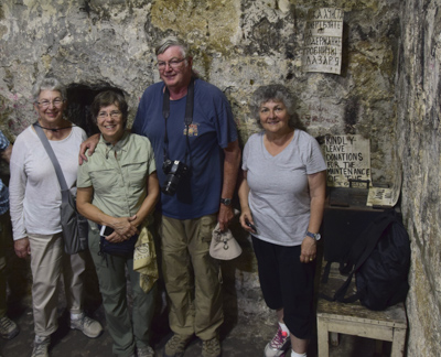
One of the members of the Samaritans met with us in a meeting area of the Samaritan Museum and Cultural Center.  She explained the history and practices of her religion.  Samaritans read and believe in the first five books of the Torah as the only true holy book given to Moses by God.  Mount Gerizim, not Jerusalem, is the true sanctuary chosen by Israel’s God.  During the holiday of Sukkoth, the sukkah is built inside houses instead of outdoors.  Sukkoth covering in the museum pictured below:

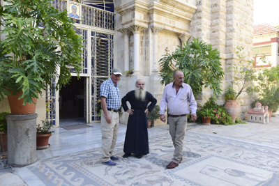
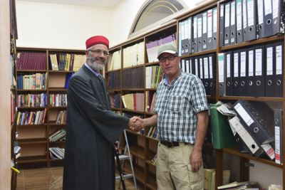
The leader of the Samaritans is called a “priest” and, following tradition, they slaughter and eat lambs on Passover eve.  We met one of the priests, who spoke perfect English, in his library where he described his books and teachings.  The high priest is pictured with Hisham in the photo below:

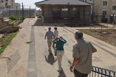
We walked across the street to the place where religious celebrations are held for the entire community.  Large pits on both sides were set up for roasting whole lambs during holidays.

We drove back down the steep hill toward Nablus.  My head was swirling with the sights today: Jacob’s Well and the story of the Samaritan woman and Mount Gerizim and Samaritan beliefs.

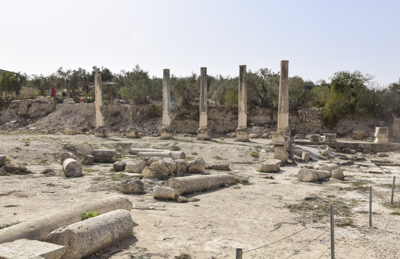
We left Mount Gerizim and drove down the steep road and back toward Nablus.  We continued on for several miles and began to climb up another single-lane road which was lined with the ruins of Roman columns. 

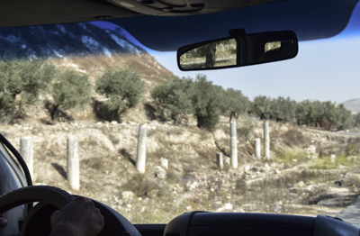
There was a large clearing at the top of the hill – sort of a parking lot surrounded with a few buildings and more columns and ruins.

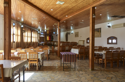
We followed Hisham into a restaurant perched on the edge of the mountain with a spectacular view of the valley.

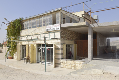
The sign on the door was intriguing and I immediately liked the restaurant:

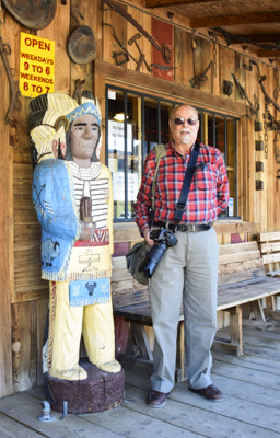
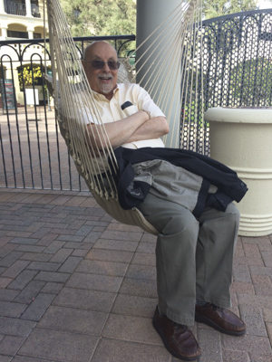
We were enthusiastically greeted by the owner and his son and shown to a table in the restaurant behind the gift shop.  The owner had attended the University of Alabama in his youth and displayed mementos of his college days in his shop.

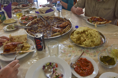
We had a delicious lunch of a variety of salads, chicken and rice, and “Palestinian pizza” made with sumac and other spices.

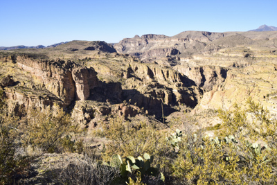
After lunch we walked on a dirt path along the ridge of the mountain, just outside the restaurant, to the archaeological site of Sebastia or Sebastiyah.  The original name of the town was Shomron and had been settled by several Israelite tribes during ancient times.  King Herod renamed the town in honor of Augustus Caesar. In Greek, sebastos means “venerable.”

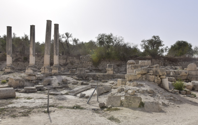
The ruins dominate the hillside and contain the remains of six successive cultures dating back more than 10,000 years: Canaanite, Israelite, Hellenistic, Herodian, Roman, and Byzantine.

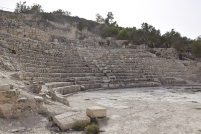
We sat on a step of the ruins of an amphitheater and Hisham told us about the history of this amazing place, Sebastia.  It was a story about historic conquerors and of the creation and destruction of the city many times during the millennia.

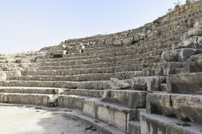
Alexander the Great destroyed the city in 331 BC to be rebuilt several times before Augustus Caesar gave it to Herod the Great.  It was the seat of a bishop and venerated during the Medieval period.  Sebastia was incorporated into the Ottoman Empire in 1517.  In modern times, the city has been under Israeli occupation after the Six-Day War in 1967.

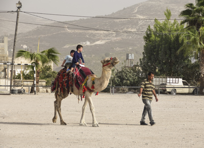
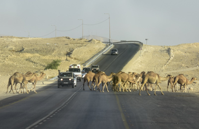
Today, during a time of relative peace, children can have a camel ride across the parking lot.

Another incredible day!


Ramallah, Palestinian Territories

October 18th, 2017

Wednesday – October 18, 2017

There was another crowd of pilgrims in the breakfast room of the Manger Square Hotel this morning.  Large groups of people from every corner of the world come to Bethlehem to visit the Church of the Nativity: Philippines, Australia, Germany, Italy, England, Africa, and, of course, the U.S.  View of modern Bethlehem this morning from my window:

It was another bright sunny morning.  We checked out of the hotel and drove north to the city of Ramallah.  On the way, we stopped at Yasser Arafat’s mausoleum.  He was the leader of the Palestine Liberation Organization for five decades, who died suddenly in 2004.

Yasser Arafat’s tomb is located in the Al Muqata’a, or Presidential Compound and is the headquarters of the current Palestinian Presidential Office and the Palestinian Authority.  The compound, which was reduced to rubble in 2002, today includes a government building, a museum which honors Arafat, his mausoleum, and a mosque.

In 1994, Yasser Arafat received the Nobel Peace Prize together with Yitzak Rabin and Shimon Peres, the Israeli leaders, for their peaceful efforts in the Oslo Accords.  The peaceful intent of the Accords divided both the Israelis and Palestinians within their own societies, and the leaders were criticized for their peace efforts by their own people.  In Israel last week, we had visited the site where Yitzak Rabin was killed in Tel Aviv.

We stopped to see the 20 foot-tall statue of Nelson Mandela which was given to the city of Ramallah by the South African city of Johannesburg in 2016.  Mandela was an ardent supporter of the Palestinian cause and a champion for Middle East peace.

One of the biggest surprises to me about the entire region, is how hilly it is!  Ramallah spreads across several steep hills.  As we drove to the city center through a neighborhood of affluent houses, I looked across a valley at the high-rises on the next hill.

Ramallah, which means “God’s hill,” is located just six miles north of Jerusalem and serves as the administrative capital of the Palestinian National Authority.  It’s a modern city with an exciting youthful vibe.  There are fashionable shops, lots of traffic, restaurants, bars, and movie theaters.

Ramallah was historically an Arab Christian town, which might account for its religiously relaxed atmosphere.  Alcohol is served in restaurants and many women do not wear headscarves.

We sampled the kebbeh cooked fresh from the street-side vendor in the photo above.  It’s made with cracked wheat, onions, finely ground beef, lamb or goat.  Hisham bought us “Palestinian ice-cream” from the famous Rukab Ice-cream Shop which has been in business since 1941.  It is gooey, sticky, and thicker than regular ice-cream, but tastes delicious.  Also called booza or mastic, it’s made from resin from a local tree.  It’s supposed to melt slower than regular ice-cream, which is a benefit in this hot climate.

More scenes walking around Ramallah:  a street vendor carving wooden trinkets:

Pharmacist describing dosage in perfect English:

Just when I thought Ramallah was a 21st century modern city, a mule and cart drove by:

Lavash & bread maker:

Farmer’s Market:

We left Ramallah and drove back into the desert northbound toward Jericho.  It was easy to forget the surrounding terrain while walking around a bustling city.

Our first stop was a cafeteria-style lunch at the Jericho Temptation Restaurant.  Afterwards, we went to the Jericho Oasis Archaeological Park.  This is the site of the tel es-Sultan, a UNESCO-listed archaeological site.

Sultan’s Hill was inhabited from the 10th millennium BC and has been called “the oldest town in the world.”  Excavations began in 1868 and continue today in cooperation with archaeologists from Rome, Italy.

A defensive wall – The Wall of Jericho – was also discovered which dates back to 8,000 BC.  We looked across the plain to the Mount of Temptation:

Close by was Hisham’s Palace which belongs to a category of “desert castles” and is an important early Islamic archaeological site.  The site was part of the Umayyad dynasty during the first half of the 8th century.

Hisham’s Palace consists of three main parts: a palace, ornate bath complex, and an agricultural enclosure or park.  There was also an elaborate irrigation system which provided the complex with water from nearby springs.

Carved stucco found at the site is of exceptional quality and decorative elements represent the finest of the Umayyad period of art.  The most famous art at the site is the “tree of life” mosaic found in the bath complex.

Below is a model of what historians believe the palace looked like:

As the sun cast long shadows on Hisham’s Palace, we left the site and drove a short distance to the Jericho Resort Village Hotel.  The dining room overlooks the outdoor patio and the pool.

The hotel was an oasis in the desert with a large hotel building and smaller family cottages built along the pool area.  We each had individual two-room suites in the cottages.  The architecture reminded me of the adobe desert communities we had been passing for the last few weeks. My cottage below:


It was a great way to end a busy day!


Hebron, Holy City in the West Bank

October 17th, 2017

Tuesday – October 17, 2017

I woke up early at 5:45, showered, and went downstairs to breakfast at the Manger Square Hotel in Bethlehem.  The large room reminded me of a “church hall social.”  There were long tables neatly set in rows with noisy smiling pilgrims milling around, talking, and eating.  Sunrise view of Bethlehem from my hotel room:

Soon we were on our way to the West Bank city of Hebron, one of the four Holy Cities of the Jewish faith, along with Jerusalem, Tiberius, and Tsfat (Safed) because of its association with Abraham.  Hebron, means “friend” in Hebrew,  and is translated to Al-Khalil or “friend of God” in Arabic.  Hebron is an ancient city with its history reaching back 5,000 years.  Today, Hebron is prosperous and thriving with a population of about 250,000 people.  It’s the largest city and the commercial capital of the West Bank.

The sign in the photo above reminded me of the division of the West Bank into three “administrative areas.”  Area A is exclusively administered by the Palestinian Authority; Area B is administered by both the Palestinian Authority and Israel; Area C – which contains Israeli settlements – is administered by Israel.  The sign informed us that we were entering Area A.

Our first stop was the Hebron Glass & Ceramic factory owned and operated by the same family since 1890.  The city is famous throughout Israel and Palestine for ceramics and glassblowing, among other trades.

After we watched the glassblowers at work, we continued to an archaeological site called Bir Haram Al-Rama (Mamre) which was first excavated in the 1920s.  It is believed to be the site where Abraham received three angels announcing the future birth of his son Issac.  It might also have been a resting place for Joseph and Mary on their way to Egypt.

King Herod the Great built an impressive complex on the site during the Roman period.  A century later, the site became one of the main market places in Palestine.  By 614 AD, a monastery was built here.  A roofed cistern with stone basins is visible in one corner of the site.

The happy sounds of school boys playing soccer in a playground behind a wall, echoed across the archeological site and reminded me of the present.  I wondered what the boys thought about the site, since it was part of their daily experiences.  What is history, after all?  History is supposed to inform, support, and enrich the present.  (?)

The Old City of Hebron was declared a World Heritage site by UNESCO in July 2017.  Given its geographic location at historic crossroads in the center of Palestine, Hebron/al-Khalil was a major center of trade and culture throughout history.  What better place to see commercial enterprise than The Souq in the Old City?

We walked through the Souq Eskafiya in the Old City, which means “Cobbler’s Market” named for the shoe industry which flourished here for many decades.  Unfortunately, the souq was mainly closed.  It was sad to see so many shops boarded up.  One of the shop keepers who spoke English described tensions with Israeli troops posted nearby.  I imagine living there is stressful for everyone.

Checkpoints, security fences, and heavy secure turnstiles are a way of life.  A small community of a few hundred Zionists settlers, driven by their faith and the importance of not abandoning the burial site of their patriarch, live above the market.  Walking down the quiet street indicated discord between two communities.

We walked through a metal detector and numerous heavy-duty turnstiles to arrive at our destination: Abraham’s Mosque.

The building that houses the Tomb of the Patriarchs is divided into two parts to serve Jewish and Muslim worshippers.  The tombs are located in a holy site under a Crusader church whose foundation walls are made of “Herod’s Stones.”  The stones have decorative carved borders and were quarried during King Herod’s reign.  We saw the same 2,000 year old stones at the Western Wall in Jerusalem.

We passed through the guarded entry of Al-Haram al-Ibrahimi (Abraham’s Mosque) and climbed the stairs to the main door.

Non-Muslim women have to cover-up in order to enter the mosque so were given blue cloaks.  We all looked pretty funny.

This is the fourth holiest site in Islam and the second holiest site in Palestine.  The Prophet Abraham resided in Hebron about 4,000 years ago.  He chose the city as a burial place for himself and his wife Sarah, his son Isaac with his wife Rebecca, and his grandson Jacob with his wife Leah.  They are also considered the Patriarchs and Matriarchs of the Jewish people, which is the reason the building is divided in half with a mosque on one side and a synagogue on the other.

According to tradition, a cave and adjoining field were purchased by Abraham as a burial plot.  The Cave of the Patriarchs is located beneath the building complex which houses the mosque and synagogue.  Four cenotaphs (empty tombs) are visible to worshippers and the general public.  Below is a photo of the stone canopy above the visible entrance to the caves, which are not accessible.

We left the mosque and walked around the building to the entrance of the synagogue.  Jacob’s and Leah’s tombs are located on this side.

We saw the other side of Abraham’s Tomb (actually empty) and a lovely library.

We walked through another section of the souq which seemed more active.

As we left the Old City, I noticed graffiti on a wall:

We had a tasty lunch at a restaurant in Hebron called Dome of the Rock which had a beaded model of the monument in Jerusalem.  Then we drove out of the city into the desert to the home of a Bedouin family.

The family had been resettled in cinder-block houses.  The boys in the extended family met with us; some were brothers, others were cousins.  They shyly practiced their English skills and a couple of the younger boys sang songs in English. One of the mothers joined us for a short time.

“And now for something entirely different….” as Monty Python used to say, we drove to one of the Israeli settlements in the West Bank named Efrat,  which was named after the biblical place Ephrath.  The settlement was established in 1983 and currently has a population of about 10,000 people.


We joined a large group from Grand Circle Tours and walked up the steep hill to one of the synagogues.  An American-born man from Pennsylvania described his experiences as a long-time resident of the settlement.  He said a majority of residents are Americans.

This was a typical house which we passed on our climb up the hill:

Unfortunately, he was defensive and arrogant when asked questions about Palestinian lands and settling on the West Bank.  He spoke of entitlement.

My head was full of inconsistencies, conflicts with no easy solution, differing opinions, and personal contacts with real people.  The tour bus drove us back to Bethlehem for a quiet evening.


Bethlehem, State of Palestine

October 16th, 2017

Monday – October 16, 2017

I enjoyed another good breakfast at the Cinema Hotel in Tel Aviv, Israel before gathering in the lobby with four other intrepid travelers.  Today was the beginning of a 5-day extension to the OAT Israel Tour which ended yesterday.  Five of us would continue to travel through the Palestinian Territory also known as the “West Bank.”  I had mixed feelings: excitement to explore a new destination but concerns about safety and unrest in the region.

Rafi Rozanes, our Israeli tour guide, was there early to help us board a new bus and get us going on another adventure.  Thank you Rafi!  We drove from Tel Aviv to the town of Beit Jala, near Bethlehem in the West Bank.  On the side of a dusty road, we switched buses and met our Palestinian tour guide, Hisham Ikhmayes.

Very soon, we were introduced to one of the contentious issues between the Palestinians and Israelis.  This was the “Israeli West Bank Barrier” aka “The Wall” aka “Security Fence” aka “Apartheid Wall.”  The wall was begun in September 2000 by the Israeli government as a temporary security measure at a time of heightened tensions.  It is now seen as a future political border between Israel and Palestine.

75% of the population of Beit Jala is Christian, mostly Greek Orthodox, and about 25% of the people are Muslim.

The photo below shows the landscape around Beit Jala – the city of Jerusalem is in the distance.  We were only 10 kms (6 miles) away from the “Holy City”.

Our bus stopped in front of the Greek Orthodox Monastery of St. Theodosius.  Hisham had noticed traffic in front of the building and told us that the monastery was rarely open for tourists.  He said we were lucky as we walked through the gates and entered the grounds of the monastery with a group of Greek pilgrims.

The Monastery of St. Theodosius was founded in 476 by Theodosius the Cenobiarch and contains his tomb.  A cave on the monastery grounds is supposed to be the place where the three Magi took shelter during the night after delivering gifts to the newborn baby Jesus.  Access to the cave is inside the small building pictured below.

We watched as an old woman dressed in black passed keys to an elderly monk in front of the building.  He opened the bronze doors and allowed the Greek tourists to enter and climb down the stairs.

We followed them down and entered the cave.  The walls were covered with stucco and filled with icons and paintings of saints.  There was a small altar on one side.  The pilgrims lined up and took turns to touch, kiss the icons, and pray.  We were indeed lucky to witness this amazing sight.

We left quietly and continued along the road through the desert to Mar Saba Monastery in the Kidron Valley.

The monastery of Saint Sabba was founded in 483 AD and is an Eastern Orthodox Christian monastery.  Today the complex houses less than 20 monks and is considered to be one of the oldest inhabited monasteries in the world.

The facility still maintains many of its ancient traditions including the restriction of women from entering the compound.  The only building women can enter is the Women’s Tower, high on a hill away from the monastery.  It’s the building on the left in the photo above.

It is believed that this monastery will host the last Divine Liturgy on earth before the second coming of Christ.

We walked to the Women’s Tower and climbed up the stairs to have a better view of the monastery.

We drove back toward Bethlehem and stopped at Shepherd’s Field.  This is the place where the angels first announced the birth of Christ.  There are two sites near each other, which are claimed by different Christian denominations to be the actual “Shepherds’ Field.”  One belongs to the Greek Orthodox Church and the other to the Catholic Franciscan Order.

We went to the Catholic Chapel of the Shepherd’s Field whose history dates back to the 5th century.  The present chapel was built near the ruins of an ancient monastery in 1953. Under the chapel there was a large cave which we also explored.

Adjacent to this site were the excavations of a 4th – 6th century Byzantine church and monastery.  We walked past and snapped a few photos.  It seems that everyone wants a piece of the “tourist pie.”

Afterwards, we had a delicious shawarma-in-pita-bread lunch at a restaurant nearby and then continued on to the city of Bethlehem.

As luck would have it, the UNESCO World Heritage Site of The Church of the Nativity was under major reconstruction and completely covered (inside and outside) with scaffolding and canvas.

Of course, this did not deter the huge crowds of tourists who traveled thousands of miles and waited in long lines in the sanctuary to finally gain entry into the very small cave under the church and crawl under the altar to touch or kiss the silver star that marks the birth site. Two million visitors go to Bethlehem every year!

It was single file down a stairway and through a short narrow portal in order to gain entry into the Grotto of the Nativity.  Underneath an altar there was a 14-point silver star mounted in marble which supposedly marked the birthplace.

Across the “cave” was another small area which is the “Grotto of the Manger.”

The Church of the Nativity is a complex of churches and chapels administered jointly by several Christian denominations: Armenian Apostolic, Greek Orthodox, Roman Catholic, and Syriac Orthodox.

The Church of Saint Catherine is adjacent to the Church of the Nativity and they were holding a mass when we looked in.  We left the churches and crossed the plaza and entered 21st century Bethlehem!  That’s The Mosque of Omar in the photo below.  It is the oldest and only mosque in the old city of Bethlehem.

We walked into a narrow alleyway and I felt immediately comfortable in the medieval middle-eastern city.  It reminded me of the back streets in Turkey.

We were on our way back to the Manger Square Hotel and we passed an interesting building on a steep hill.

This was the Church of the Mother of God, Syrian Orthodox Church.  Many Syriac Orthodox families had migrated to Palestine and settled in Bethlehem as a result of the genocide in 1915 by the Ottoman Turks.  The Syrian Christian community built the church between 1922-1928.

We were lucky again because the caretaker of the church was standing outside.  Hisham spoke to him and he opened the door and led us into the beautiful sanctuary.  The caretaker very proudly showed us the ancient illuminated bible in front of the altar.  The Syrian Orthodox Church traces its roots to one of the oldest communities of Antioch and was established as a congregation by the Apostle Peter in 37 AD.

The Manger Square Hotel was a short walk away.  We checked in and found our assigned rooms.  Dinner was in a large dining room with many tables set up and reserved for groups with religious affiliations: “Mother Fatima’s Group,” “Evangelical Pilgrims Group,” “Faith Ministry Group,” etc. etc.  We ate an interesting self-serve dinner of bright-green soup, lamb stew, rice with peas and beans.  The soup was a Middle-Eastern favorite  and comfort-food and made from a plant called molokhia or mulukhiyah, also called Jew’s mallow or jute.  It was delicious.

Below are two views of Bethlehem from my room window.  It had been another incredible day!