Rainy Sunday – September 12th
I can’t believe another rainy day in Delft, Netherlands! We had a good European breakfast in the dining room of the Hampshire Hotel and were determined to continue with our plans to visit some new places in Holland. We were going home on Tuesday and we wanted to enjoy our last two days.
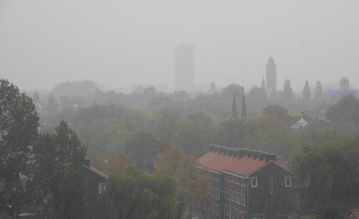 Morning view of Delft from our 7th floor balcony
The Netherlands is really a very small country and you can get almost anywhere in a couple of hours. Jeff and I wanted to visit the area north of Amsterdam called Wieringermeer Polder and see the Afsluidijk. The word ‘polder’ means land reclaimed from the sea, lake, or marshland. To create a ‘polder’, the area is enclosed with dykes and then the water is pumped out and the water level is regulated. Originally windmills pumped out the water, these were replaced by steam and diesel engines, and today electric pumps control the water.
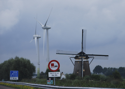
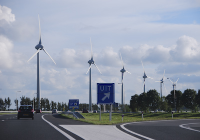
From Delft, we got on the A-4 and drove north. Today, the countryside of the Netherlands is filled with a new kind of windmill which generates electricity. I like this photo that I took from the car, along the A-4 of an old fashioned traditional wooden windmill next to two tall stark-white wind-turbines:
We continued north of Amsterdam along the two-lane road, the N-9. This flat almost-straight road passes the shore villages along the North Sea. The area is famous for its cheese auctions, herring fishing, and whaling in the 16th century. It is also a seaside resort area of beaches with a number of hotels and restaurants.
Alkmaar is the largest city on the peninsula, with a population of 94,000 people. It’s hard to believe that Alkmaar was besieged in 1573 by the Spaniards and Holland was under Spanish rule for almost a hundred years. As the story goes, heavy autumn rain flooded the countryside and forced the assailants to withdraw. As a result, Alkmaar is credited with being the first town to resist the Spaniards. Fortunately for us, the weather was clearing the further north we drove.
We drove all the way to the top of the peninsula, to a town named Den Helder. We didn’t know what we would find there because there wasn’t much information in our Michelin Guide. We were very pleasantly surprised to see a very appealing town and interesting things to do. The guide said that Den Helder is the Netherlands’ chief naval base and naval ships could be seen at the docks in the distance. At the end of the road, there is a ferry terminal which goes to Texel. This is the largest of the Wadden Islands which form a string of barrier islands protecting the northern part of the Netherlands from the ravages of the North Sea. According to the Michelin Guide, Texel has several interesting villages.
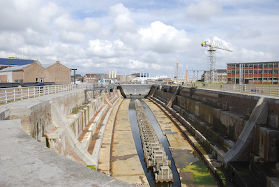 Dry Dock for a huge commercial or naval ship
Also in Den Helder are a naval museum, a national maritime rescue museum, an aquarium, several beaches, a nature reserve, and six forts which had been built by Napoleon. Unfortunately, it was Sunday and most of these were closed, but we promise to return and explore this very interesting area in the future.
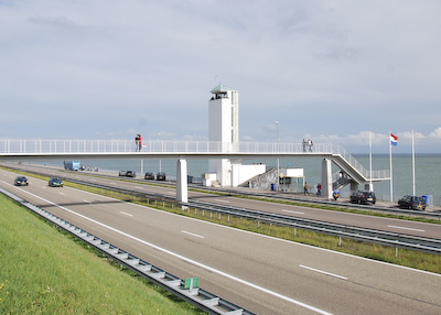
Our goal was to see and cross the famous Afsluitdijk and return to Delft before dark. We continued on the road heading north. There was very little traffic, the weather had cleared, and because the land is so flat, one could see for miles. It is a place where land, sea, and sky meet. The road of the Afsluitdijk lunges out into the blueness and it visually cuts into the middle of the sea, with salt water on one side and fresh water on the other.
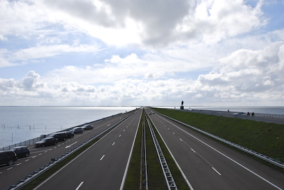 View From the Middle of the Bridge over the Afsluitdijk
The Afsluitdijk was built in 1932 as a huge barrier dam creating the outer Waddenzee and an inland freshwater lake, now known as the Ijsselmeer. Once the lake was enclosed, work began to create other polders and huge tracts of land were reclaimed. The Afsluitdijk was a monumental project which was planned by Dr. Cornelis Lely in 1891. It took backbreaking intensive labor to build the dyke which is 19 miles long, 330 feet wide, and is 23 feet above sea level.
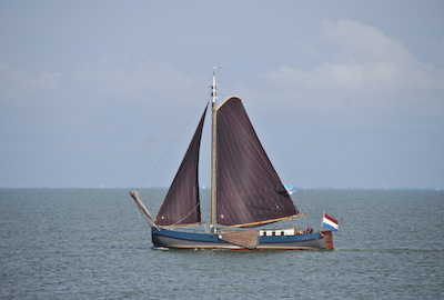
Many communities around the shores of what used to the the saltwater Zuiderzee lost their livelihood when access to the open sea was shut off. Some of the fishing boats that now sail the Ijsselmeer hoist dark-brown sails as a sign of mourning for their lost sea fishing.
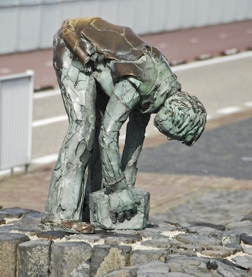
Midway along the dyke’s length, at the point where it was completed in 1932, stands a monument to “the men who put their backs to the task”, and a monument to Dr. Lely. Tourists can stop for a snack at the charming cafe in the base of the tall tower or cross the pedestrian bridge over the road for a great view of the project from the North Sea side.
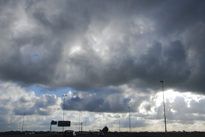
We stopped at the parking area near the bridge to take photographs and explore what was there. We walked across the bridge to look at the North Sea. Surprisingly, it was calm despite the stiff breeze. Perhaps the Wadden islands were doing their job. Afterwards, we continued to drive to the end of the Afsluitdijk, then we made a U-turn and drove back south on the dyke toward Amsterdam and Delft. The sun was setting and huge dark clouds were rolling in from the west as we approached Delft. It had been a good day.
