Cruising to Bolivia

May 29th, 2015

Friday – May 29, 2015

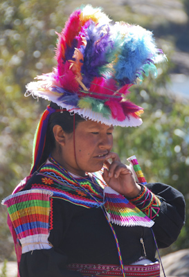
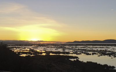
Lake Titicaca was a sacred place to the Incan people because they believed it was the birth place of the sun. The god Viracocha came out of the waters and created the sun, the stars, and the first people. As I watched the sun rise over the lake this morning, I could appreciate the mythology.

IMG_3811

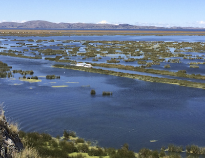
Today was our day to travel to Bolivia. The original plan was again thwarted by the miners’ strike so Marcos arranged for us to traverse the entire length of the lake (180 miles) from Puno, Peru to Huatajata, Bolivia by hydrofoil then take a bus to the capitol city: La Paz.

DSC_0350

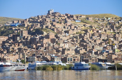
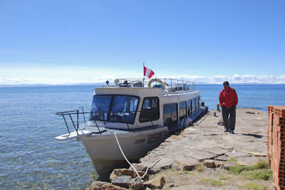
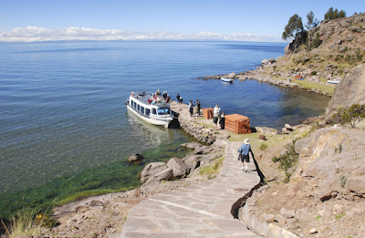
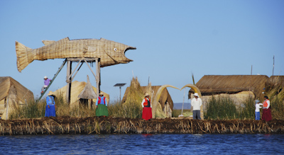
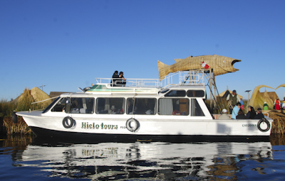
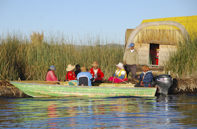
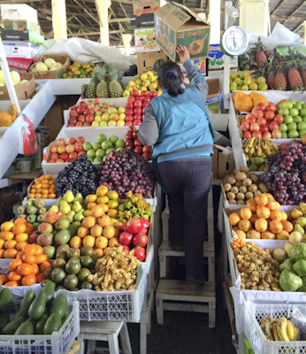
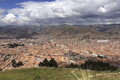
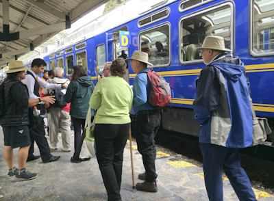
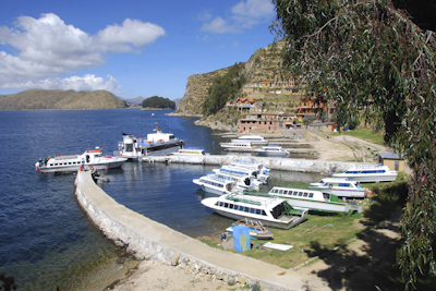
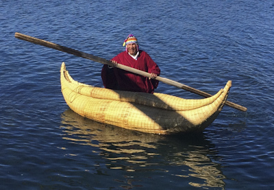
The air temperature was forty-two degrees in the morning when the group boarded two small power boats like the one pictured below.  The boat drove toward the city of Puno on the other side of the bay and the captain stopped the engines. The water was calm and we drifted for about thirty minutes. I stepped out on the aft deck to take photos of Puno from the water. (photo above)

IMG_3822

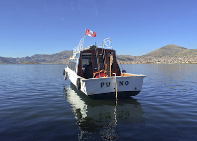
We had given our passports and papers to Marcos and we waited patiently for a Peruvian official as the boat continued to drift. We quietly watched as a middle-aged man in military uniform boarded our boat and went to the forward deck with Marcos to review our passports and clear us out of Peru. The customs inspector’s business took about fifteen minutes. Then he returned to his boat, our captain started the engines, and we were on our way.  The hydrofoil flew a Bolivian flag, so we were officially in Bolivia!

IMG_3830

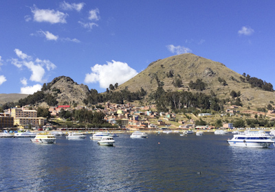
After several hours on the lake, we approached the lovely town of Copacabana. The hydrofoil tied up at the dock and we were allowed to step off. The dock belonged to the land-locked Bolivian Navy and we were warned NOT to take photos of the military base or our cameras would be confiscated. I didn’t take any photos of the two-story white stucco building which looked more like a boater’s clubhouse from the 1950’s. Two customs officers boarded our hydrofoil to check our passports and clear us into Bolivia. We were told there were long lines at other customs offices on the lake and this would be the easiest and quickest way to gain entry into the country.  It certainly was interesting.

DSC_0363

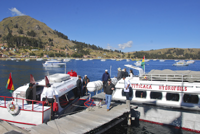
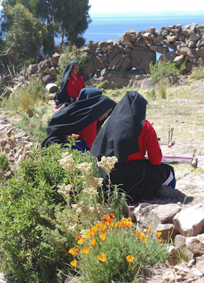
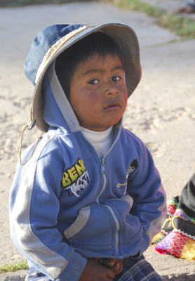
Back on the hydrofoil again, this time on our way to Isla del Sol for our first Bolivian lunch. There are no motor vehicles or paved roads on the hilly island which has been inhabited for four thousand years. The eight hundred families who live there today survive by farming, fishing, and tourism. 

DSC_0400

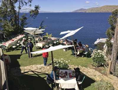
We climbed up steep stone steps to a tourist restaurant overlooking the blue lake. Tables had been set outdoors and we enjoyed trout, rice, and several different kinds of potatoes. Isla del Sol is the largest island on Lake Titicaca and regarded as the home of the supreme Inca god, Inti. There are many ancient ruins located on the island including a ‘fountain of youth.’ Unfortunately, we didn’t have time to stop there and check it out.

IMG_3837

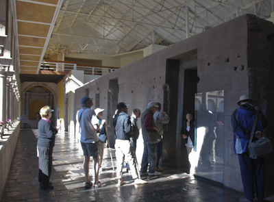
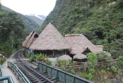
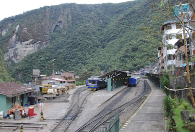
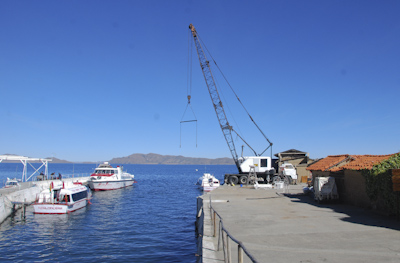
The hydrofoil continued through the narrow Straits of Tiquina and finally arrived in the town of Huatajata. Our boat tied up at the dock and we stepped off while the boatsmen handled our luggage. There was a boatyard crane on the cement pier and the Limachi family’s museum beyond.

DSC_0429

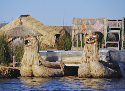
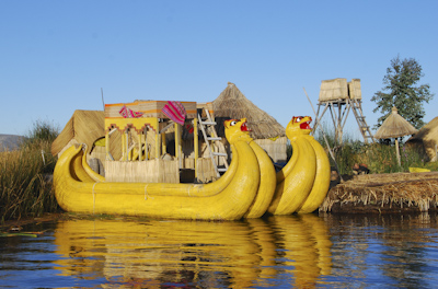
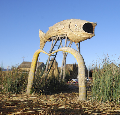
The museum shows how early Aymara people lived centuries ago. The Limachi family specialized in building ocean-going boats built from the lake reeds called ‘totora.’ The reeds on Lake Titicaca are similar to reeds on the Nile River and several explorers theorized ocean crossings on these boats. Limachi-built ships have successfully sailed across the Pacific, Atlantic, and Mediterranean Seas.

DSC_0445

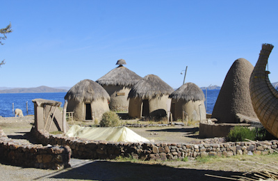
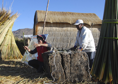
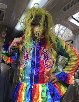
The reed ship, shaped like a Viking longboat, is locally called a ‘Thunupa’ after an Andean deity. The family patriarch, Demitrio Limachi, helped build the most famous reed boat, the Ra ll with Norwegian adventurer Thor Heyerdahl in 1970. One of the Limachi brothers, pictured below, came out to greet our boat.

IMG_3843

DSC_0427

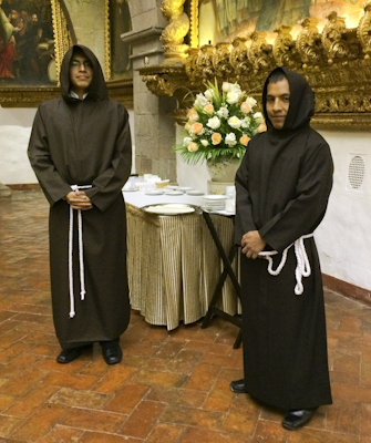
After touring the museum and taking photos, we boarded a motor coach for the two-hour drive to Nuestra Señora de La Paz, the Bolivian capital.

DSC_0461

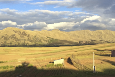
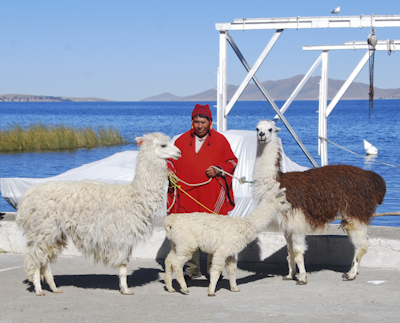
The Andes Mountains towered over the roadway as we traveled through the high plains of Bolivia. I had read about the thousands of llama and alpaca herds which roamed this region during ancient times and enticed the Incan king to invade the territory because he needed the animals for work and food for his growing empire. Manpower and llamas ultimately built the vast Incan Empire which covered almost the entire western coast of South America. 

DSC_0475
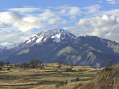
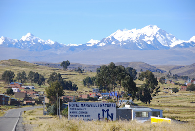
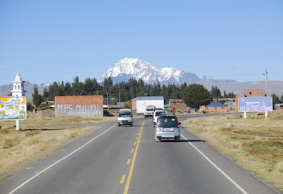
21,000′ Snow-covered Mt. Illimani

We were lucky to sit behind the driver and it was a very pleasant drive through the Altiplano (high plains) until we approached La Paz. As the traffic increased and red-clay buildings multiplied, I felt as if I was sitting in a movie theater looking out of the windshield screen at a human hive of activity. 

DSC_0490

DSC_0512

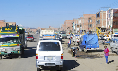
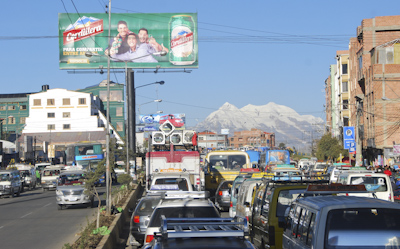
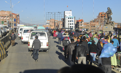
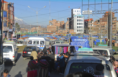
We approached El Alta, or The Heights, which is a suburban city just outside La Paz, situated on the high plains at an altitude of 4000 meters (13,000 feet). This is the fastest growing urban center in Bolivia with a growing population of one million. Eighty-five percent of the people are Aymara and Quechua Amerindians. Our bus inched along in unbelievably heavy traffic teeming with vehicles and pedestrians threading their way along the main road. I had a bird’s eye view of the activity and was grateful that I wasn’t driving.

DSC_0516

DSC_0519

Eventually, we arrived in La Paz and our motor coach descended into the valley which comprises the highest administrative capital in the world. We stopped briefly at an overlook to see the city below. It’s only 3500 meters (11,500 feet) above sea level.

IMG_3890

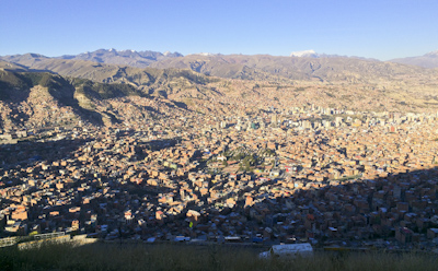
The city of La Paz filled the area between the mountains to look like a large bowl filled with red-clay buildings oozing their way up the sides. Another million people live in this bowl.

IMG_3896

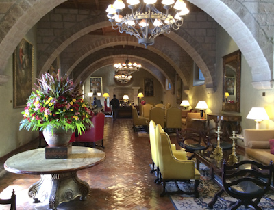
It had been a long day filled with many unusual sights and sounds and it was good to arrive at our hotel: the Camino Real Suites located in the Calacoto neighborhood of the city. This was supposed to be in the southern part of the city where the altitude was lower than the rest of La Paz, but at 3300 meters (11,000 ft) we were still ‘up in the air.’  I rested and looked forward to seeing more of the city tomorrow.

Taquille Island in Lake Titicaca

May 28th, 2015

Thursday – May 28, 2015

We found ourselves gliding across Lake Titicaca in a small ferry boat under a brilliant blue sky. I think I’ve never seen a sky as blue. At 12,500 feet, there’s very little air pollution and the cool air seemed ‘crystal clear.’

DSC_0192

Taquille Island was thirty miles offshore from the city of Puno. The lake was calm and it was a very enjoyable way to spend the morning. About two thousand people live on the three-mile long rocky island.  Marcos told us that, unlike the people of Uros who are friendly and outgoing, the Taquilenos are very shy. The women especially do not smile at or talk to strangers.

DSC_0189

We were greeted warmly by a group of singers and dancers. We were out of breath after we slowly walked up the steep path. The small band wore traditional costumes and preformed a circular folk dance for our group with drums and pan-pipe music. We were informed that the handicrafts made on the island were recognized as ‘heritage art’ by UNESCO. The Taquilenos women make yarn and were weavers while the men did the knitting.

DSC_0209

DSC_0198

DSC_0214

Near the top of the hill there were several buildings and a flat open area. We sat on stones to watch a demonstration of the textile techniques of the islanders and how they use all the plants and animals which grow there. I noticed several women slowly approaching our seating area. They all wore black skirts, red long-sleeve shirts, and black head-coverings. They sat down on the ground and set up their simple looms and silently began to weave.

DSC_0234

DSC_0238

The islanders continue the ancient Incan tradition of a collectivist society of sharing everything and live by the Quechua moral code: ‘do not steal, do not lie, do not be lazy.’ The people fish, raise sheep and cows, and grow all their own food. Today, tourism supplements their economy.

DSC_0283

We had a delicious lunch in a small building which was set-up as a tourist dining room. We had quinoa soup, lake trout, and a variety of potatoes cooked several ways.

DSC_0297

DSC_0304

On this fall day, I enjoyed the tranquility of Taquille Island and the company of the shy, gentle people who live here simply and make beautiful textiles.

DSC_0332


Lake Titicaca – The Uros People

May 27th, 2015

Wednesday – May 27, 2015

Yesterday had been a very long day when we arrived at the Libertador Lago Hotel late last night. Marcos gave us a “leisurely morning” and we needed it. When I finally awoke and looked out on glistening Lake Titicaca, I was relieved we made it there. It had been a grueling night driving slowly in the bus on bumpy roads in pitch darkness. We didn’t know when the curfew would start or if we could avoid it. We passed through several very poor, shuttered villages and I was glad we didn’t have to ‘find a place to stay.’

IMG_3734

Lake Titicaca! The incredibly blue lake is one of the largest lakes in South America and, at 12,500 feet elevation, is the highest navigable body of water in the world. I learned the deep lake is 120 miles long and fifty miles wide and divided into three parts. We were in the northern, shallow section across from the city of Puno.

DSC_0063

After a restful morning, Marcos arranged for us to visit the Uros people on one of their floating reed islands. In order to be fair to everyone, they try to regulate which island tourists can visit at any particular time. We were allowed to visit ‘Big Fish’ Island.

DSC_0121

The people originally built the moving islands to flee from invading Incans who were pushing south but were eventually conquered. Today, the Uros continue to live as they have for centuries subsisting on fish, birds, edible parts of the reeds, and quinoa.

DSC_0060

DSC_0071

We watched a demonstration of how the islanders use bundles of dried totora reeds and roots to construct the islands. Reeds are also used to build their houses, mats, boats, towers and anything else they need. Dense root bundles form supports which are anchored to the ground.  New reeds are piled on top for a thickness of approximately two or three feet. Because they rot away, the reeds are replenished every three months, or as needed.

DSC_0098

We were invited to enter the home of the Uros man and woman pictured above. It was a simple room with a carpet-covered large bed and reed benches along the walls. A single light bulb hung from the ceiling which was attached to a small outside solar collector.  I noticed a pan-pipe and a boom-box in one corner. A few articles of clothing hung on pegs pushed through the reed walls. The man said they had five children and two grandchildren who still lived on their little island.

DSC_0139

There were currently about forty-two islands ranging in size from three to ten families. The islands are approximately a hundred to two hundred feet across depending on the number of people/families who live there.

DSC_0108

DSC_0094

DSC_0058

DSC_0131

Tourists have helped the economy of the Uros people, to enable them to purchase what they need from the city. However, numerous tourists have caused damage to the islands, increasing the need for maintenance. Recently, more young people prefer to live in the city. I wonder about the future of the gentle Uros people who live such a fragile existence. 

DSC_0119

Short Day in Cusco, Peru

May 26th, 2015

Tuesday May 26, 2015   Another bright beautiful cloudless day.
Last night we had just enough time to find our rooms and get ready for dinner at the Monasterio’s elegant dining room.  Unfortunately, one of the women in our group became very ill due to altitude sickness.  Cusco, located at 11,200 feet above sea level, caused the fierce headaches I experienced during the night. I used the oxygen tank in our room for ten minutes, according to directions, took two Advils, and felt better.  We explored the Monasterio grounds briefly and then had a wonderful buffet breakfast outdoors in the garden. Someone commented that the former monastery was still owned by the Vatican, but I find that hard to believe. Nonetheless, it’s a fabulous place to stay and I wish it was at a lower altitude because I would enjoy a return visit.

IMG_3626

IMG_3631

Marcos, the tour director, warned us about a miners’ strike in southern Peru which might cause us to change our schedule.  He promised to keep us posted.  Our local guide, Maria, met us at the Monasterio and we went out to see Cusco. Our first stop was Coricancha, the Sun Temple of the Inca. The structure had been used as a shrine for offerings to the sun, as well as a solar observatory, and a storehouse for mummies. 

DSC_9789

The Incans had covered the south-facing wall with gold to reflect the sun and gold sculptures filled the shrine. After the Spanish conquistadors took over Cusco, they melted down the gold, dismantled most of Coricancha, and built Santa Domingo church and convent on top of the temple. The sacred place of the Incas was hidden until an earthquake in 1955 destroyed most of the newer construction and exposed the solidly built walls.

IMG_3633

The site is now a museum and a testament to the ingenuity and skill of the Inca people. The solidly built blocks of stone were precisely carved and placed to create the temple which is expected to last through any future earthquakes.

DSC_9834

The city of Cusco had been the capital of the Inca Empire and was known by the Incans as the ‘Navel of the World.’ It is the oldest continuously inhabited city in the Americas and a UNESCO World Heritage Site. Francisco Pizarro and his Spanish conquistadors arrived in Cusco in 1532 driven by their greed for gold. Our next stop was the covered Mercado San Pedro. I love markets! Here were the descendants of the Incas, the Quechua people, shopping for their daily needs. 

IMG_3656

IMG_3643

IMG_3645

IMG_3659

IMG_3670

Afterwards, we continued our tour of Cusco to another UNESCO World Heritage Site. The red tile roofs of houses reached up over the the sides of the mountains surrounding the city as our bus climbed up to the ruins of Saqsaywaman. This is a huge hilltop Incan fortress overlooking Cusco. It is a maze of zig-zagging walls and terraces built from gigantic stones in about 1100 AD.  The Incan people’s most ferocious battle against the Spaniards took place here in 1536. 

IMG_3697

DSC_9920

DSC_9940

Below is a view of Cusco from an overlook at Saqsaywaman.  Today there is a population of 500,000 people living in the city which attracts two million tourists a year. Two flags fly in the plaza: one is the red and white symbol of Peru and the other is the rainbow flag of the descendants of the Inca people: the Quechuas. Maria proudly told us that the people of Cusco are ‘Mixtos’ and the culture and traditions are a combination of Incan and Spanish. 

IMG_3702

Marcos informed us that a forty-eight hour miner’s strike was planned to begin tomorrow and our south-bound train was canceled. He said he was trying to find transportation for us and we had to leave Cusco today. We would have to take a bus to Puno because all the roads will be closed beginning at midnight.  We had time for one more tourist attraction in Cusco, the famous cathedral in the Plaza de Armas.

DSC_9981

The  baroque Catedral de Santo Domingo was built between 1560 and 1664 from red granite stones taken from the fortress of Saqsaywaman. The cathedral houses several altars and chapels made of beautifully carved wood overlaid with gold and silver.  Distinctive “Cusco School” paintings created in the eighteenth century adorn the walls.  The most famous of these is a painting of The Last Supper by the Peruvian Quechua artist, Marcos Zapata in 1753. The table is laid with Peruvian food including the Andes delicacy of cuy, cooked guinea pig. (Sorry, no photography in the cathedral!)

DSC_9321Lucky Bulls on the Roofs

There was a lot of activity and so much to see and do in the Plazas de Armas, but we had to return to the Monasterio Hotel to prepare for an early departure to Puno. We were originally scheduled to leave tomorrow on the famous Orient Express Train to Lake Titicaca, but the train company cancelled all trips because of the strike taking place in southern Peru. We learned later there had been riots with bombs and four people had been killed by the military.

DSC_9991

We packed quickly and had a light lunch of quinoa soup in the hotel restaurant. Then we boarded a bus and drove out of Cusco about 3:30 for the long ride to Puno. We watched the Peruvian countryside from the window of the coach until darkness and finally stopped for supper about 7:00 PM at a roadside restaurant. The food was cold so I didn’t eat anything except white rice and a few fried potatoes. At 8:10 pm the guide announced that we were passing the highest point of the trip: the town of Raya at 14,200 feet above sea level. We finally arrived at the hotel on the shores of Lake Titicaca close to midnight. It had been a very long uncomfortable drive, but we made it!

Aguas Calientes to Cusco

May 25th, 2015

Monday – May 25, 2015

The weather was cool, drizzly and overcast this morning. We had the option to get up before dawn and catch the bus back up to Machu Picchu to see the sun rise over the mountains. However, we both felt we had been fortunate to have a bright sunny day yesterday when we visited the historic site. Seeing it in the rain would not be much fun and we were tired and needed a rest!  

DSC_9670

At 7,000 feet above sea level, walking up the hills was an effort for me. So we enjoyed a leisurely breakfast, explored the beautiful grounds of the Inkaterra Machu Picchu Hotel and walked slowly around the town of Aguas Calientes. 

DSC_9672

DSC_9685

DSC_9679

There are no automobiles in Aquas Calientes because of the narrow steep streets with many steps. The town was built on the slopes of the mountains along the Rio Vilcanota and is purely a tourist stop on the way to Macchu Picchu.

DSC_9702

DSC_9681

DSC_9726

DSC_9690

DSC_9683

The only vehicles are the green buses which take people to Machu Picchu and the trains which transport tourists in and out of the village.

DSC_9727

DSC_9719

DSC_9739

After lunch, we boarded the Peru Rail train to take us back to Ollantaytambo to get a motor coach for the three-hour ride to the city of Cusco.  We were treated to music and a fashion show on the train.

IMG_3548

IMG_3556

IMG_3554

Below are my last views of the Sacred Valley and the Andes Mountains which surround and protect the incredibly beautiful and fertile high plains.

IMG_3589

IMG_3588

We stopped at a rest area which overlook the valley. There were families of local people selling handicrafts and some children in costume who charged one nuevo sol for photographs. They were really cute and they enjoyed practicing their English skills.

DSC_9742

DSC_9747

DSC_9750

DSC_9752

DSC_9754

We arrived in Cusco and changed buses from the large motor coach to two smaller buses which could navigate the narrow streets of the historic neighborhood of the city. It was a short drive to the Belmond Hotel Monasterio on Calle Palacios. Two wide doors were opened and we were greeted by monks serving hot coca tea. We stepped over the threshold and into a gold filled chapel. I didn’t know whether to pray or whip out my camera and take pictures. (I did the latter!)

IMG_3602

IMG_3600