Sea Day – Greenland to Newfoundland

September 3rd, 2017

September 3, 2017

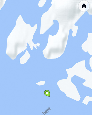
There were four long blasts of the horn to say goodby and the M. S. Rotterdam slowly pulled away from Nanortalik, Greenland yesterday afternoon.  The ship moved at a snail’s pace through the waters of Cape Farewell’s fjords trying to avoid icebergs, or “sea ice” as they call them here.

The sea ice drops into Davis Strait and the Labrador Sea from glaciers on the western coast of Greenland.  Currents, wind, and tides slowly move them southward along the strait which is commonly known as “Iceberg Alley.”
IMG 2218

Again we have two Ice Pilots from Greenland aboard to assist the captain to get us through the treacherous waters.  We will meet them in the theater later this afternoon for a Q & A Session.

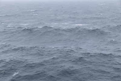
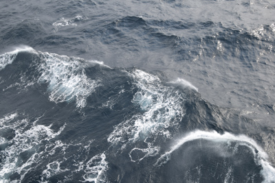
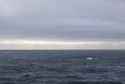
Once the ship was clear of the rocky coast of Cape Farewell, the southern most part of Greenland, we picked up speed and cruised through Iceberg Alley in a southwesterly direction toward Canada.  The seas were rough all night with winds upward of 45 miles per hour, so the ship rolled and pitched.  Our cabin creaked and swayed with the rise and fall of the ship on the undulating sea.

A few facts are shown all day long on one of the channels of our television: wind speed, temperature, sunrise, sunset, depth of the water, and distance covered since we left Boston on August 2nd.  I love to see the progress of the ship and the change in wind and water.  This morning, as we crossed the Labrador Sea, it was 11,840 feet deep.  We have traveled almost 8000 miles in thirty days.  Amazing trivia!!

Now that we’ve been cruising for a month, we’re still not sure if cruise ships are for us.  This particular cruise is filled with staunch Holland America groupies.  Of the 1400 passengers aboard, one thousand are 4 or 5 Star Mariners which means a significant number of them have cruised on HAL for more than 500 days.  Of the remaining 400 passengers, there is a significant number of 3 Star Mariners who will move up to 4 Star status after this cruise.  When we asked these people about the benefits of Mariner status, they unanimously answered, “free laundry.”  Seems like a steep price to pay for clean clothes.
DSC 4933

Translated this means: entitlement.  As one woman with more than a thousand cruise days told us, “I paid for this ship.”

We spoke to one man who informed us that he had already accumulated 207 cruise days so far this year (!!) and this was his 10th Voyage of the Viking cruise.  Yes, he has taken this cruise nine previous times.  Unbelievable….

I think I could be the only NO Star passenger on the ship, (my first Holland America cruise) but I remain openminded. Jeff has ONE star; I don’t know why or how he got it and I didn’t, since this is his first HAL cruise also.  So, as I said, I might have the distinction of being the only No-Star Mariner….

We’ve met people with thousands of cruise days and many multiple Grand Voyagers – that means they’ve sailed around the world.   The vast majority of passengers are seniors, spanning the decades from retiree through to their 90s.  There are many staunch sailors with canes, walkers, and wheelchairs.  Gives me something to look forward to!

One positive aspect of this cruise line is that it has interesting lectures.  Today is a Sea Day, so there were four lectures.  The first was Location Guide Barbara, presenting information about St. John’s, Newfoundland.  Then Tim Calvert talked about Christopher Columbus.  This topic seemed a bit a bit strange to me since this is the “Voyage of the Vikings.”  However Tim supported the notion that Columbus was NOT the first European to arrive on North American shores.  Interestingly, he also said Columbus was disliked by his contemporaries and died a very wealthy man at 56 years of age.  I can’t understand why we continue to celebrate Columbus’ non-discovery!

Another lecture was presented by Dr. Bendel, the meteorologist, who talked about the EXO-planets, very large planets billions of miles away, and tried to define What is Life.  He also mentioned Saturn and the space craft Cassini which has been transmitting data and photos from Saturn for the last 20 years.  Cassini is due to end its mission on September 15th by its final transmission to NASA before crashing into Saturn.

Finally, the best entertainment of the day was the talk given by the two Danish Ice Pilots who came aboard the ship in Iceland and helped Captain Eric van der Wal navigate through Prince Christian Sound, along the fjords of south Greenland, in and out of Nanortalik harbor, around Cape Farewell, and across Iceberg Alley.  They went with us all the way to Canada.

Pictured below are the Danish Ice Pilots, with Jan, our cruise director.  The pilots were former captains, each with 40 years of sea experience:

IMG 2223

I learned a lot about icebergs/sea ice!  Most of the icebergs drop off glaciers on the western coast of Greenland and the currents and wind push them down Iceberg Alley.  There are no glaciers on the eastern coast of Canada.  The large flat-top icebergs come from the eastern coast.  The pieces that split off larger icebergs are called “growlers.”  Smaller pieces are called “berger bits.”  The Ice Pilots said there were no advanced electronic navigation aids for Greenland.  “The coastlines were largely uncharted.”  Only paper charts existed for some regions so the Ice Pilots came along to help the captain read the paper charts. Unbelievable!!  It was an interesting Q & A session.
DSC 4929

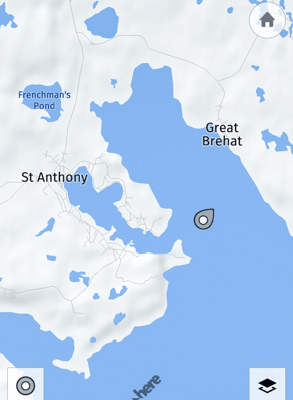
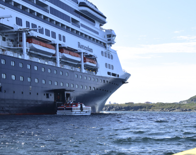
Today is a quiet day to relax.  By the late afternoon the wind diminished and the seas were calmer.  The ship isn’t rockin’ ’n’ rollin’ as much.  Tomorrow we’ll pull into St. Anthony, Newfoundland & Labrador, Canada for a tender ride into town.

We’re approaching the end of our Voyage of the Vikings.  It will be good to go home and sleep in my quiet, non-swaying, motionless bed!
Nanortalik, Greenland

September 2nd, 2017

Saturday – September 2, 2017

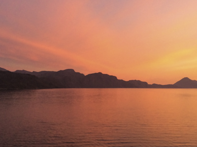
Early light over Greenland:

IMG 2200

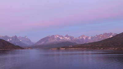
Morning light over Nanortalik, Greenland:

DSC 4750

Not in my wildest dreams did I ever expect to visit Greenland – let alone two villages!  As I walked along the gravely roads of Nanortalik today, one thought kept surfacing:  wow! I’m really in Greenland!  I can’t believe I’m walking on Greenland!  Greenland wasn’t on my ‘Bucket List.’
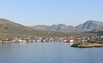
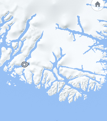
Below is a map of the southern coast of Greenland called Cape Farewell.  the location of the village of Nanortalik is marked:

IMG 2204

The view from the tender as we approached the tiny village of Nanortalik:

DSC 4763

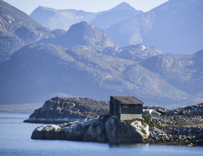
We left incredibly beautiful Prince Christian Sound by early evening and slowly cruised along the rugged south Greenland coast.  It’s hard to believe the Vikings considered settling among the tall jagged rocks which jut out of the deep sea.

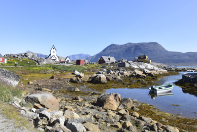
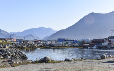
Several of my photos taken on Nanortalik:

DSC 4791

DSC 4783

It had been a calm night.  The ship didn’t have far to go to reach the island of Nanortalik at the mouth of the Tasermiut Fjord, so the ship hugged the shore and cruised slowly.  When the Rotterdam reached the village very early in the morning, it dropped anchor and we enjoyed a few calm hours.

DSC 4915

DSC 4779

There was a buzz in the elevator that some people had seen Northern Lights last night.  They said it was a green haze in the clear sky.  I guess the conditions were just right for an Aurora Borealis, which are more frequent in the winter in Greenland.  It was a dry crisp morning – a cloudless 41 degrees.

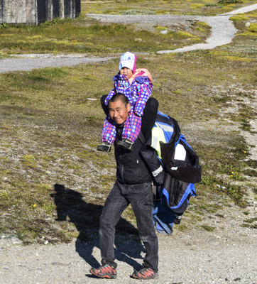
The father carried his young child and a huge backpack along the road on their way to his boat:

DSC 4800

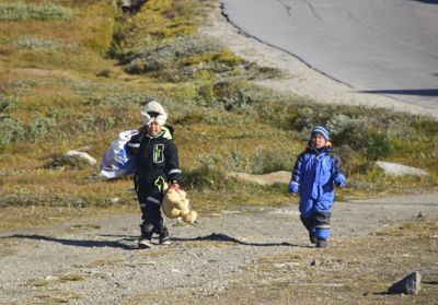
Children in snowsuits hurried along way behind their dad.  One of them is carrying a stuffed Winnie the Pooh doll:

DSC 4805

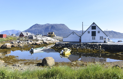
The village of Nanortalik is located on an island of the same name and is the southernmost town in Greenland with a population of about 1350 people.  Nanortalik means “the place with polar bears” and is the 10th largest village in Greenland.

DSC 4808

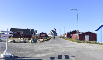
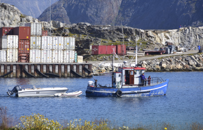
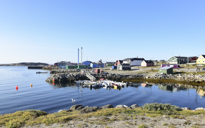
The village a flat shelf of solid rock surrounded by vertical cliffs and steep peaks.  There was a relatively small harbor for fishing boats, small container ships, and a large building which was probably a fish processing plant.  The small simple houses were painted in bright colors.

Advertisement outside the only supermarket:  A cold soda and a hotdog is 25 Danish Kroners

DSC 4846

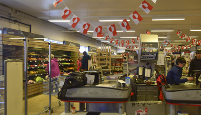
Inside the supermarket with Greenland flags flying:

DSC 4838

Jeff and I boarded the tender and thought we wouldn’t be spending much time in Nanortalik.  Four hours later, we barely made one of the last tenders back to the ship.

DSC 4866

We walked all over the village and took lots of photos because the weather was clear and sunny; perfect for taking pictures.  We tried to imagine what it would be like to live in Nanortalik in the dark northern winters.  There was one supermarket, ( which was part of a Danish chain), a school, a tourist information shop, two hotels (one boarded up), a tiny store selling new & used clothing, a church, a heliport, hospital, and an excellent living Heritage Museum.

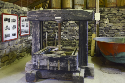
Whale blubber press for extracting oil:

DSC 4875

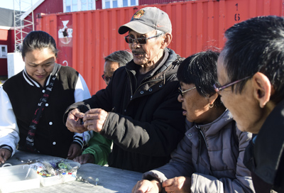
We ended up paying $5.00 each go through the living-history Heritage Museum buildings.  There was a charming grandfatherly local man collecting the entrance fee.  The museum is made up of a dozen small buildings with specific themes of early life in Greenland.  My favorite was the whale and seal processing house.  It had an actual “blubber press” as well as huge vats and barrels and other tools of the whale processing trade.

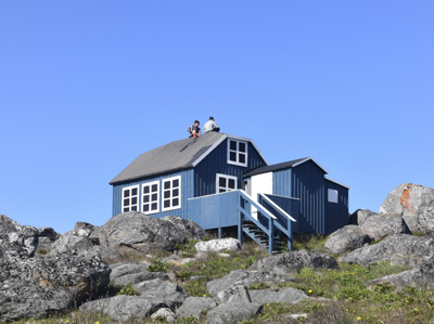
Young boys on the roof of a house watching the tourists:

DSC 4900

Another building housed a baking and brewing shop.  Inside one building there was an exhibit of small whale boats and an antique kayak.  We could have spent more time touring the museum, but unfortunately our time on Nanortalik was limited and we had to return to the ship by 1:30.

DSC 4884

The Rotterdam turned around and cruised out of the harbor and into the North Atlantic Ocean.  Huge icebergs, or “sea ice” as it’s called in Greenland, lined the shore.  Sometimes the sea ice is so prevalent it collects in Nanortalik’s harbor and closes access to the tiny village.

DSC 4823

Captain van der Wal announced potential heavy seas ahead and sizable waves as we made our way westward to our next port of call: St. Anthony, Newfoundland.

Cruising Prince Christian Sound Greenland – Westward

September 1st, 2017

Friday – September 1, 2017

DSC 4556

We set the clocks back another hour last night.  Since we’re heading westbound, we’re getting back those hours we lost when we began this journey.  We left Isafjordur, Iceland the day before yesterday and cruised down the body of water between Iceland and Greenland known as the Denmark Strait.  The seas were not as rough as Captain van der Wal predicted they might be.  Fortunately.

DSC 4566

Passengers get up to the minute reports on current conditions on one of the channels of the television.  I was amazed to see depths of eight to over nine thousand feet.  This is the location of the world’s highest underwater waterfall.  It’s three times taller than the earth’s highest waterfall and no-one can see it because it’s underwater.

The waters between Greenland and Canada are called “Iceberg Alley” because the huge chunks of ice break off glaciers on the western coast of Greenland and float down the strait.  They seem to collect among the islands on the southern coast of greenland called Cape Farewell.

DSC 4587

At six o’clock this morning the fog horn announced the current visibility: dense fog.  I could barely see the water outside from our balcony.  The air temperature was 35 degrees Fahrenheit.  The sun was trying to come out and it brightened into a bright sunny day by eight o’clock.  The ship barreled toward shore.  The Rotterdam is the fastest ship in Holland America’s fleet and we guessed the captain was testing its limits.

DSC 4623

The jagged peaks of Greenland came into view as we approached the narrow opening of Prince Christian Sound on the southeastern corner of this amazing country.  As we got closer, the coastline was littered with icebergs of all sizes and shapes.  We remembered that we could not cruise the entire length of the Sound a couple of weeks ago when we left Qaqartoq and sailed into Prince Christian Sound on our way to Iceland.  We went about three quarters of the way and had to turn around because the eastern end was blocked by ice.

DSC 4625

DSC 4643

The sun brightened and Captain van der Wal slowed the ship considerably.  Three very large icebergs sat impressively at the mouth of the sound.  We tried to guess the ship’s route.  We remembered they announced that two Danish “Ice Pilots” stationed in Greenland came aboard to get us through the narrow sound.  I guess they were earning their salaries today.

IMG 2182

DSC 4653

DSC 4656

The ship slowly crawled past the first iceberg then cut between the next two icebergs and slowed it’s pace, giving us lots of time to take many photos of the floating ice.  The water looked very cold.  We were reminded that 90% of the iceberg’s mass was underwater.  So the ice pilots gave them a wide berth.

DSC 4687

DSC 4721

DSC 4736

For the next several hours, the ship creeped along the narrowest part of the Prince Christian Sound.  The entire “Sund,” as it’s called in Danish, is incredibly beautiful and awe-inspiring.  There are not adequate words to describe the steep rocks, glaciers, jagged mountains, waterfalls, and icebergs.

IMG 2189

IMG 2191

IMG 2193

The ship approached a large glacier and stopped.  Then, believe it or not, the Rotterdam did a 360 degree turn right in front of the glacier, between the narrow stone walls of the Sound.  It was incredible!  Captain Eric van der Wal was showing off!

DSC 4736

DSC 4745

DSC 4746

Near the western approach to Prince Christian Sound is a tiny village of about a hundred people:

DSC 4754

This was an unforgettable day!!!

Sea Day – Iceland to Greenland

August 31st, 2017

Thursday – August 31, 2017

We left Isafjordur, Iceland about five o’clock yesterday and cruised through the magnificent Isafjardardjup fjord and out to the Norwegian Sea.  Captain Eric van der Wal  made an announcement to expect heavy seas of twelve to fourteen feet during the night, but fortunately it was a smooth ride and I slept soundly.

DSC 4547

Today the Rotterdam is moving southwest through the Danish Strait on our way to Greenland.  The fog horn sounded early this morning and the horizon is a misty line between the inky sea and the gray sky.  I hope the radar works!

We went up to the Crow’s Nest which is in the bow above the Bridge.  This is the “room” where the officers navigate and ‘drive’ the ship.  In the old days it might have been called “the wheelhouse” but today’s ships don’t have wheels; they have something that resembles a ‘joy stick’ to steer the gigantic ship. I think it would be fun to see the Bridge and the crew in action, but they never allow spectators.  I believe they use Auto-Pilot and technology most of the time when the ship is just cruising.

Anyway, we like to sit in the Crow’s Nest on the comfortable chairs facing out to sea and the horizon, sort of like getting the captain’s view.   We took our laptops and worked on our respective blogs.  An elderly man sat next to me and he began talking to me.  His name was Charlie and he told me he was 90 years old this year.  I tried to type, but Charlie seemed to want to talk and he told me all about his experiences during World War II.  And about his childhood and his two girlfriends, and his wife, and other details of his life.  He was an interesting character with a long life.  As he talked, the weather cleared.  Charlie eventually left to meet with a group of American veterans.  He sort of lives on the ship.

DSC 4541

After lunch, we went to a presentation by Location Guide Barbara who told us all about Nanortalik, Greenland.  This was one of the towns located in the southern part of Greenland that we would be visiting next.

The bakers and pastry chefs on the ship did a great job!  Too good!  There was a variety of excellent breads and delicious pastries:

IMG 2178

We also went to a lecture given by Dr. Bendel who talked about the Solar System.  Dr. Bendel was a meteorologist who had an interest in astronomy and his lectures were very good.

The day passed quickly…….

Isafjordur, Iceland

August 30th, 2017

Wednesday – August 30, 2017

DSC 4359

The Rotterdam left Akureyri yesterday evening and cruised north along the Eyjafjordur fjord.  The ship crossed the Arctic Circle during the night and cruise director Jan announced that Holland America will give us certificates to mark our crossing.  Amazing!  I never thought I would ever travel this far north.

DSC 4364

DSC 4369

A thin beam of gray light through the curtains woke me up this morning and I looked out to see the side of a mountain.  Very close.  The ship had traveled up the Isafjardardjup fjord on its way to the tiny fishing village of Isafjordur.  Jeff and I watched as the Rotterdam turned around 180 degrees in the narrow fjord then very very slowly moved sideways and tied up alongside the pier.  It was a painstaking but successful maneuver accomplished by the people on the bridge.

DSC 4379

We looked out at the commercial dock where we had tied up.  Container ships are the only way people in Isafjordur get any supplies.

DSC 4388

From our balcony, we could see large fishing boats docked across the waterfront and fish processing buildings on the other side of the harbor.  The weather was cool (9 degrees C) – 45 degrees F – and cloudy, but not raining.

DSC 4389

The main part of Isafjordur lies at the base of a very tall mountain and along the deep fjord. The commercial port and the older part of town jut out into the water in an L-shaped peninsula.  It looks like the village expanded along the road.  Isafjordur (population 2,600) means “fjord of ice” in Icelandic.  The region has a subarctic climate of cold high winds and very few clear days.

DSC 4401

The town grew in the 16th century as a trading post for foreign merchants.  We discovered the Westfjord Heritage Museum which is a maritime museum housed in an 18th century house.  Built in 1734, it is the oldest house in Iceland.

DSC 4439

We walked out to explore the town and see what the fishing village was like during the summer.  There were a few small hotels and guest houses on the main road.  It looked like there was one road that ran along the water and out of town.

DSC 4443

Looking back toward our ship, the Rotterdam was dwarfed by the tall mountains surrounding it on both sides of the fjord.  Isafjordur was a very well protected harbor.  Fishing is the main industry in town and it has one of the largest fisheries in Iceland.

DSC 4446

We walked along the narrow streets of Old Town and saw brightly painted 19th century homes.  The sides and roofs of the buildings were covered in corrugated metal.

DSC 4476

We explored the supermarket and I bought a couple of postcards and stamps in the postoffice.  It’s a neat and clean town, of course overrun today with tourists from our ship.  We didn’t see many local people, except shopkeepers.

DSC 4504

Jeff had coffee and a large slice of blueberry cake in the warm and toasty Gamla Bakariid (bakery) while I wrote postcards.  The sky darkened and the wind picked up.  It was difficult to believe it was August.  We walked back to the ship to warm up and relax.

DSC 4532

We talked about what Isafjordur must be like to live in, especially during the winter.  I wondered if the only road into town was closed during snow storms and whether the fishing boats operate in the cold dark months of December, January, and February.

DSC 4536

It is just amazing to be in Isafjordur, Iceland…..